Geoscience Maps
The British Columbia Geological Survey's vehicle for publishing final maps.
Jump to:
2025 | 2024 | 2022 | 2020 | 2018 | 2017 | 2016 | 2015 | 2014 | 2011 | 2010 | 2009 | 2008 | 2007 | 2006 | 2005 | 2004 | 2003 | 2002 | 2001 | 2000 | 1998 | 1997 | 1995 | 1994 | 1993 | 1991
2025
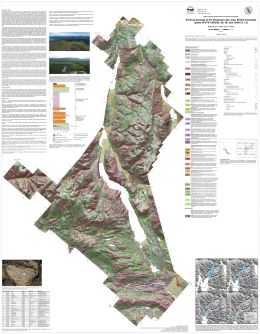
Sauvé, M., Ward, B., and Ferbey, T.
The Kinaskan Lake map area is characterized by uplands comprised of exposed bedrock and discontinuous veneers of till and colluvium which are separated by large valley systems containing thick accumulations of glacial and non-glacial sediments. Organic material recovered between two till units, and radiocarbon dated at >54,000 C14 years BP, indicates a minimum of two regional-scale glacial advances for the area. The upper till, the most extensive surficial sediment in the region, was deposited by the Cordilleran ice sheet during the Fraser Glaciation. Ice-flow direction during this advance was variable. A combination of landform- and outcrop-scale glacial features indicates that ice initially flowed towards the northeast and then transitioned to northwest-flow as the glacial maximum was approached. During deglaciation, localized lakes formed on the plateau surfaces and an extensive ice-dammed proglacial lake developed in the Kinaskan Lake valley and its tributaries. Glaciolacustrine sediments were deposited in these lakes and landforms such as deltas and shorelines delineate their areal extents. During the Holocene, large bedrock landslides developed at the edges of the plateaus and smaller landslides initiated in Quaternary sediments occur across the modern landscape. Patterned ground in the form of mud boils, solifluction lobes, and boulder stripes indicate active periglacial processes and discontinuous permafrost in the higher elevations of the map area.
2024
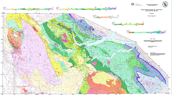
P. Schiarizza
The Bonaparte Lake-Quesnel River map area covers 15,375 square kilometres of south-central British Columbia, mainly in the Fraser Plateau, Quesnel Highland, and Shuswap Highland physiographic provinces, in the traditional territories of the Secwepemc, Esk’etemc, Tsilhqot’in, and Lhtako Dené First Nations. The area is mainly underlain by early Mesozoic rocks of Quesnel terrane, but also includes Paleozoic rocks of Slide Mountain and Kootenay terranes to the east and late Paleozoic-early Mesozoic rocks of Cache Creek terrane to the west. Quesnel terrane is subdivided into eastern and western belts. The predominant western belt includes arc volcanic and sedimentary rock of the Nicola Group, which is subdivided into seven main units, establishing a stratigraphic succession ranging from Middle Triassic to Early Jurassic. Permian, Triassic, and Early Jurassic rocks of the eastern belt are of uncertain relationship to the Nicola Group, but correlate with rocks in the eastern part of Quesnel terrane to the southeast of the map area. Late Triassic to Early Jurassic plutonic rocks of Quesnel terrane include the Late Triassic Granite Mountain batholith, host to the Gibraltar Cu-Mo porphyry deposit, and latest Triassic monzodiorites of the Copper Mountain suite, host to the Mount Polley Cu-Au porphyry deposit.
2022
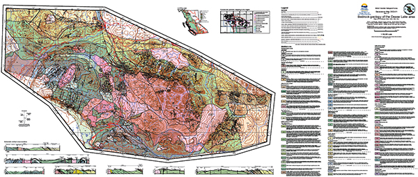
Bram I. van Straaten, James M. Logan, JoAnne L. Nelson, David P. Moynihan, Larry J. Diakow, Rohanna Gibson, Sebastian J. Bichlmaier, Curran D. Wearmouth, Richard M. Friedman, Martyn L. Golding, Emily A. Miller and Terry P. Poulton
Geoscience Map 2022-01 portrays the bedrock geology of a 5,000 km2 area in northwestern British Columbia between the community of Dease Lake and the Stikine River (parts of NTS sheets 104G, 104H, 104I and 104J). This geology is based on mapping by the British Columbia Geological Survey carried out between 2011 and 2018. Rocks in the map area are mainly in the Stikine terrane, a Paleozoic to Mesozoic island arc that was deformed in the latest Triassic to Early Jurassic before accreting to ancestral North America in the Middle Jurassic. The oldest units in the map area are meta-sedimentary and meta-volcanic rocks of the Stikine assemblage (Devonian to Permian). Subsequently, the area experienced repeated calc-alkalic to alkalic, arc to arc-like magmatism from the Middle Triassic through the Late Jurassic. This includes Tsaybahe group volcanism (Middle Triassic), Stuhini Group volcanism (Late Triassic), and Stikine suite plutonism (Late Triassic). This magmatism was followed by latest Triassic deformation and a latest Triassic to Early Jurassic depositional and magmatic hiatus that has been attributed to collision between the Intermontane terranes. Subsequent upper Hazelton Group volcanism (late Early to Middle Jurassic), Three Sisters suite plutonism (Middle Jurassic), and Snowdrift Creek suite plutonism (late Middle to Late Jurassic) formed during and after accretion of Stikinia and other Intermontane terranes to ancestral North America. During this deformation, sedimentary rocks of the Whitehorse trough (Upper Triassic to Lower Jurassic) were thrust southward overtop of Stikinia. Deformation was accompanied by deposition of sedimentary rocks of the Bowser Lake Group (Middle Jurassic and younger). As a result of this protracted magmatic history, the area is prospective for intrusion-related magmatic-hydrothermal mineral deposits, as illustrated by the Gnat Pass porphyry copper deposit and numerous other porphyry, epithermal, and skarn prospects.
2020
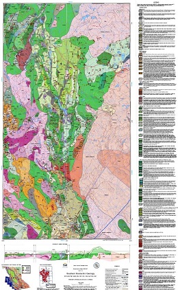
M.G. Mihalynuk and L.J. Diakow
Geoscience Map 2020-01 represents an area of approximately 2000 km2 in southwestern British Columbia, extending from southeast of Merritt to Princeton. It is centred on volcanosedimentary rocks of the Late Triassic Nicola arc, which is endowed with significant porphyry copper-gold-molybdenum-silver deposits. Active mines are in the south, near Princeton (Copper Mountain), and in the north, near Kamloops (Highland Valley and New Afton). About a third of the map area is underlain by Jurassic intrusions that cut deformed Nicola arc strata, mainly in the east. Volcano-sedimentary strata of both the Spences Bridge Group (Early Cretaceous) and Princeton Group (Eocene) unconformably overlie the early Mesozoic rocks, particularly in the western part of the map area. All Eocene and older rocks are faulted, tilted, and locally folded beneath scattered remnants of Miocene to Pleistocene Chilcotin Group and 'Valley basalts'. Rare occurrences of unnamed supraglacial volcanic spatter are limited to two areas, each less than 100 metres in diameter, and are important examples of possibly the youngest subaerial volcanic rocks in British Columbia.
2018
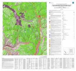
A. Plouffe and T. Ferbey
Late Wisconsinan, Fraser glaciation till is the most extensive surficial sediment in the Highland Valley Copper mine (porphyry Cu-Mo) area. During the Fraser glaciation, ice flowed predominantly south to southeastward as indicated by the orientation of drumlins and flutings. During deglaciation, lateral meltwater channels cut into the flanks of valleys and mountain slopes, indicating that ice occupied low ground when higher elevations were ice free. Accumulations of glaciofluvial sand and gravel, too small to be mapped at this scale, can be found close to these meltwater channels. The glaciofluvial drainage was generally to the south during ice retreat, with aggradation of glaciofluvial sediments in the Guichon Creek valley. Glaciolacustrine sediments in the Witches Brook valley were deposited in a lake that formed when the eastward drainage was blocked by a mixture of ice and sediments. Mine tailings blanket areas near open pits and in the valley that extends northwest from the mine (previously occupied by Pukaist Creek).
This map supersedes Geoscience Map 2015-03.
2017
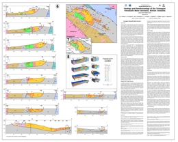
The Turnagain Alaskan-type intrusion in northern British Columbia belongs to a global class of ultramafic-mafic intrusions emplaced at convergent margin tectonic settings that are gaining prominence as exploration targets for magmatic Ni-Cu-PGE sulphide mineralization. The Turnagain body is unusually enriched in Ni(-Co) sulphides compared to typical Alaskan-type intrusions. In terms of contained Ni metal, the low-grade mineralization at Turnagain ranks ninth among the world’s largest deposits, constituting a total resource of 1842 Mt @ 0.21 wt % Ni and 0.013 wt % Co.
Geoscience Map 2017-1 provides a compilation of the geology (1:10,000 scale), incorporating historical and modern exploration work, and geochronological results (U-Pb, 40Ar/39Ar) for the intrusion and its host rocks. A series of transverse and longitudinal sections controlled in part by drillhole information are used to construct a conceptual 3-D model of the intrusion. Field observations and geochronology establish a multi-stage history of emplacement in the Early Jurassic, with four distinct intrusive phases spanning at least 3 million years (~188-185 Ma). The geochronological results indicate two separate episodes of sulphide mineralization hosted by different intrusive phases: an early event that produced the main Ni(-Co) resource; and a younger event that gave rise to significant Cu(-PGE) mineralization, a potential future resource. From regional geological studies and geophysical surveys, we infer that deformation of the Turnagain intrusion was during accretion of an outboard arc assemblage (Quesnellia/Yukon-Tanana terranes) onto miogeoclinal strata of the ancient North American margin. The geochronological data bracket this accretionary event to after ca. 185 Ma (mid-Early Jurassic) and before ca. 171 Ma (early Middle Jurassic).
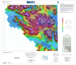
O. Boulanger and F. Kiss
Also published as Geological Survey of Canada Open Files 8287 and 8290
These maps were derived from data acquired during an aeromagnetic survey carried out by Goldak Airborne Surveys from March 10, 2017 to July 6, 2017. The nominal traverse and control line spacings were, respectively, 400 m and 2400 m, and the airplane flew at a nominal terrain clearance of 150 m. Traverse lines were oriented N45°E with orthogonal control lines. The flight path was recovered following postflight differential corrections to the raw Global Positioning System (GPS) data and inspection of ground images recorded by a vertically-mounted video camera. The survey was flown on a pre-determined flight surface to minimize differences in magnetic values at the intersections of control and traverse lines. These differences were computer-analysed to obtain a mutually levelled set of flight-line magnetic data. The levelled values were then interpolated to a 100 m grid. The International Geomagnetic Reference Field (IGRF) defined at the average GPS altitude of 1950 m for the current mid-survey date of 2017/06/08 was removed. Removal of the IGRF, representing the magnetic field of the Earth's core, produces a residual component related almost entirely to magnetizations within the Earth's crust.
The first vertical derivative of the magnetic field is the rate of change of the magnetic field in the vertical direction. Computation of the first vertical derivative removes long-wavelength features of the magnetic field and significantly improves the resolution of closely spaced and superposed anomalies. A property of first vertical derivative maps is the coincidence of the zero-value contour with vertical contacts at high magnetic latitudes (Hood, 1965).
For data along strike to the north, see BCGS Geoscience Map 2017-4
Data coverage extends from northwestern British Columbia into Yukon as Geological Survey of Canada Open File 8289 and Yukon Geological Survey Open File 2017-61. These publications are available for free download through GEOSCAN and from the Yukon Geological Survey P.O. Box 2703 (K-102), Whitehorse, Yukon Y1A 2C6. Telephone (867) 667-3201, email: geology@gov.yk.ca
Corresponding digital profiles and gridded data and similar data for adjacent airborne geophysical surveys are available from Natural Resources Canada's Geoscience Data Repository for Geophysical Data.
The same products are also available, for a fee, from the Geophysical Data Centre, Geological Survey of Canada, 601 Booth Street, Ottawa, Ontario K1A 0E8. Telephone: (613) 947-3337, email: NRCan.infogdc-infogdc.RNCan@canada.ca
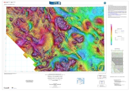
O. Boulanger and F. Kiss
Also published as Geological Survey of Canada Open Files 8288 and 8291
These maps were derived from data acquired during an aeromagnetic survey carried out by Goldak Airborne Surveys from March 10, 2017 to July 6, 2017. The nominal traverse and control line spacings were, respectively, 400 m and 2400 m, and the airplane flew at a nominal terrain clearance of 150 m. Traverse lines were oriented N45°E with orthogonal control lines. The flight path was recovered following postflight differential corrections to the raw Global Positioning System (GPS) data and inspection of ground images recorded by a vertically-mounted video camera. The survey was flown on a pre-determined flight surface to minimize differences in magnetic values at the intersections of control and traverse lines. These differences were computer-analysed to obtain a mutually levelled set of flight-line magnetic data. The levelled values were then interpolated to a 100 m grid. The International Geomagnetic Reference Field (IGRF) defined at the average GPS altitude of 1950 m for the current mid-survey date of 2017/06/08 was removed. Removal of the IGRF, representing the magnetic field of the Earth's core, produces a residual component related almost entirely to magnetizations within the Earth's crust.
The first vertical derivative of the magnetic field is the rate of change of the magnetic field in the vertical direction. Computation of the first vertical derivative removes long-wavelength features of the magnetic field and significantly improves the resolution of closely spaced and superposed anomalies. A property of first vertical derivative maps is the coincidence of the zero-value contour with vertical contacts at high magnetic latitudes (Hood, 1965).
For data along strike to the south, see BCGS Geoscience Map 2017-2
Data coverage extends from northwestern British Columbia into Yukon as Geological Survey of Canada Open File 8289 and Yukon Geological Survey Open File 2017-61. These publications are available for free download through GEOSCAN and from the Yukon Geological Survey P.O. Box 2703 (K-102), Whitehorse, Yukon Y1A 2C6. Telephone (867) 667-3201, email: geology@gov.yk.ca
Corresponding digital profiles and gridded data and similar data for adjacent airborne geophysical surveys are available from Natural Resources Canada's Geoscience Data Repository for Geophysical Data.
The same products are also available, for a fee, from the Geophysical Data Centre, Geological Survey of Canada, 601 Booth Street, Ottawa, Ontario K1A 0E8. Telephone: (613) 947-3337, email: NRCan.infogdc-infogdc.RNCan@canada.ca
2016
T. Ferbey, V.M. Levson, and A. Plouffe
Also published as Geological Survey of Canada Canadian Geoscience Map 252
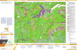
The Moffat creek area includes the Woodjam porphyry Cu-Au-Mo developed prospect. Between Moffat and Woodjam creeks, this prospect consists of six mineralized zones: Megabuck, Deerhorn, Spellbound, Southeast, Takom, and Three Firs. Till deposited during the Late Wisconsinan Fraser Glaciation is the predominant glacial sediment in the area. Landform-scale ice-flow indicators such as drumlins and crag-and-tail ridges, and outcrop-scale features, such as striations, demonstrate that ice initially flowed south-southwest and later flowed north-northwest. Hummocky topography and eskers suggest that deglaciation was, at least in part, via downwasting of stagnant ice masses. Important accumulations of glaciofluvial sand and gravel deposits in the Horsefly River valley, and in lower volumes in the southwest part of the study area, represent sources of construction aggregate. Retreat-phase glaciolacustrine sediments were deposited in the Horsefly area and Beaver Creek valley at elevations of up to 800 m above sea level. These deposits could be contemporaneous with, and related to, higher water levels in the Fraser or Quesnel river systems during deglaciation and the formation of glacial Lake Fraser. Alternatively, they could be related to local damming of the Beaver Creek and Horsefly River drainages.
2015
M.J. Manor, C.J. Wall, R.M. Friedman, J. Gabites, G.T. Nixon, J.S. Scoates, and D.E. Ames
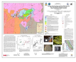
The Giant Mascot ores belong to a class of convergent margin Ni-Cu-PGE deposits that are becoming an increasingly important, yet under-explored, economic resource. Mineralization is generally hosted by small ultramafic-mafic intrusions containing hornblende and characteristic orthopyroxene. The orthopyroxene distinguishes these bodies from classical Alaskan-type intrusions in the supra-subduction zone environment. Geoscience Map 2015-01 summarizes new and historic data for the Giant Mascot Ni-Cu-PGE sulphide deposit, incorporating recent research by Manor (MSc thesis, UBC, 2014) and original work by Aho (1954, 1956).
The Giant Mascot mine (1958-1974), the only past-producer of nickel in British Columbia, yielded over 4 Mt of ore with an average grade of 0.77 wt % Ni and 0.34 wt % Cu. The sulphide ores are hosted by the Giant Mascot ultramafic intrusion, which forms an elliptical plug (~4 km2) that is crudely zoned from a core of dunite and peridotite through pyroxenite to a discontinuous rim of pegmatitic hornblendite-hornblende gabbro. The intrusion is hosted by amphibolite-grade, metasedimentary rocks of the Settler schist (Upper Triassic ) and the Spuzzum pluton (Late Cretaceous). New U-Pb zircon and 40Ar-39Ar determinations indicate a crystallization age of ca. 93 Ma (Late Cretaceous) for the ultramafic suite, and a slightly older but statistically distinct age (ca. 95 Ma) for Spuzzum diorite, consistent with observed contact relationships. These results confirm the age of mineralization and establish the Giant Mascot ores as the world’s youngest known magmatic Ni-Cu-PGE sulphide deposit.
The sulphide ores exhibit unambiguous magmatic textures and are mainly hosted in dunite, peridotite and pyroxenite. The multiple ore zones form small, discrete bodies with pipe-like, lensoid, and tabular morphologies, and enclose massive, net-textured and disseminated sulphides (mainly pyrrhotite, pentlandite and chalcopyrite). The sulphide ores have high tenors (3-14 wt % Ni, 0.1-17.1 wt % Cu, and 84 ppb to 5 g/t total PGE; recalculated to 100% sulphide), and distinct Ir-group PGE in the Western vs Eastern mineralized zones. Platinum-group minerals are mostly bismuthotellurides, exsolved during cooling and fractionation of base-metal sulphides. The geometry, internal characteristics, and contact relationships of the ore-bearing structures are consistent with the features exhibited by magmatic conduits. These narrow conduit systems pose a significant challenge to exploration, yet the presence of PGE-enriched, high-tenor sulphides underscores the potential for economic Ni-Cu-PGE deposits in convergent margin environments.
This project is part of the Targeted Geoscience Initiative 4 (TGI-4) program funded by Natural Resources Canada and administered by the Geological Survey of Canada in collaboration with the British Columbia Geological Survey.
S. Hashmi, A. Plouffe, and B.C. Ward
Also published as Geological Survey of Canada Canadian Geoscience Map 209
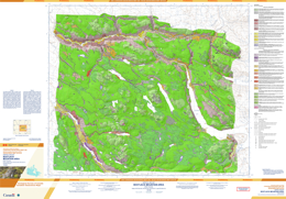
Till deposited during the Fraser Glaciation (Late Wisconsinan) is the predominant surficial material in the Bootjack Mountain area. Distributed as a regional blanket, till also defines streamlined, hummocky, and ridged landforms. Glaciofluvial sediments, mainly outwash terraces, mark ice retreat; kame terrace and ice-contact deposits record ice stagnation. Glaciolacustrine deposits form veneers and blankets along Beaver Valley. Holocene colluvial and alluvial sediments are exposed along the Beaver, Quesnel, and Cariboo river valleys. The colluvium forms blankets, veneers, aprons, landslide, and hummocky deposits, whereas the alluvium forms terraces, plains, and fans. Meltwater channels align mainly along the general ice-flow direction (northwest-southeast). Northwest-trending ice-flow indicators (293°–330°) overprint those trending west-southwest (255°–275°), indicating two glacier movement directions.
this map is superceeded by Geoscience Map 2018-01
A. Plouffe and T. Ferbey
Also published as Geological Survey of Canada Canadian Geoscience Map 214
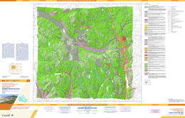
The Gnawed Mountain area includes the Highland Valley Copper mine (porphyry Cu-Mo), which is a major copper producer in Canada. Near the mine, till deposited during the Late Wisconsinan Fraser Glaciation is the most extensive glacial sediment. Glaciers flowed predominantly south to southeastward during this glacial event, as indicated by the orientation of numerous drumlins and flutings. During ice retreat, lateral meltwater channels cut into the flanks of valleys and mountain slopes indicating that ice occupied low ground when higher elevations were ice free. Accumulations of glaciofluvial sand and gravel, too small to be mapped at this scale, can be found close to these meltwater channels. The glaciofluvial drainage was generally to the south during ice retreat, with aggradation of glaciofluvial sediments in the Guichon Creek valley. Glaciolacustrine sediments in the Witches Brook valley were deposited in a glacial lake that formed when the eastward drainage was blocked by a mixture of ice and sediment. Mine tailings (anthropogenic deposits) are near open pits and in the valley that extends northwest from the mine (previously occupied by Pukaist Creek).
This map was produced as part of a joint initiative of the Geological Survey of Canada and the British Columbia Geological Survey, conducted under the auspices of the Intrusion-Related Ore System project as part of Natural Resources Canada’s Targeted Geoscience Initiative-4 program.
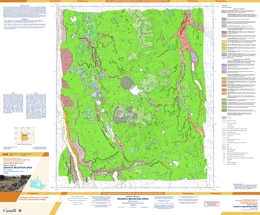
The Granite Mountain area, in south-central British Columbia, includes the Gibraltar Mine (porphyry Cu-Mo deposit). Most of the map area is underlain by till of the Late Wisconsinan Fraser Glaciation. During deglaciation, meltwater channels were eroded in the hillsides of Granite Mountain and the mountainous ridge north of the mine indicating that ground at high elevation was deglaciated first. Meltwater was generally routed to the north through two main corridors: one in the west, in the region trending north from Cuisson Lake and a second one in the east, in the valleys of Ben and Skelton lakes and Arbuthnot Creek. Glaciofluvial sediments deposited during ice retreat represent potential granular resources. A glacial lake and associated delta are mapped north of Ben Lake from aerial photograph interpretation. At the western edge of the map area, large landslides most likely in bedrock and unconsolidated sediments occurred along the bedrock escarpment of the Fraser River valley. Anthropogenic deposits including wet and dry tailings surround Gibraltar Mine.
This map was produced as part of a joint initiative of the Geological Survey of Canada and the British Columbia Geological Survey, conducted under the auspices of the Intrusion-Related Ore System project as part of Natural Resources Canada’s Targeted Geoscience Initiative-4 program.
2014
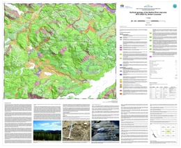
T. Ferbey
Also published as Geoscience BC map 2014-09-01
The Nadina River map area is in the Nechako Plateau, a subdivision of the Interior Plateau with flat to gently rolling topography. The area has an extensive drift cover and sparse bedrock outcrop. This map is an ancillary product of a study devoted to till geochemistry (Ferbey, 2010a, b), and is based on air photo interpretation and widely spaced ground observations.
References
Ferbey, T., 2010a. Quaternary geology and till Geochemistry of the Nadina River map area (NTS 093E/15), west-central British Columbia. In: Geological Fieldwork 2009, British Columbia Ministry of Energy, Mines, and Petroleum Resources, British Columbia Geological Survey, Paper 2010-1, pp. 43-54.
Ferbey, T., 2010b. Till Geochemistry of the Nadina River map area (093E/15), west-central British Columbia. British Columbia Ministry of Energy, Mines, and Petroleum Resources, British Columbia Geological Survey, Open File 2010-7, Geoscience BC, Report 2010-10, 56 p.
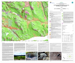
T. Ferbey
Also published as Geoscience BC Map 2014-09-02
The Colleymount map area is in the Nechako Plateau, a subdivision of the Interior Plateau with flat to gently rolling topography. The area has an extensive drift cover and sparse bedrock outcrop. This map is an ancillary product of a study devoted to till geochemistry (Ferbey, 2011a, b), and is based on air photo interpretation and widely spaced ground observations.
References
Ferbey, T., 2011a. Quaternary geology and till geochemistry of the Colleymount map area (NTS 093L/01), west-central British Columbia. In Geological Fieldwork 2010, British Columbia Ministry of Energy, Mines, and Petroleum Resources, British Columbia Geological Survey, Paper 2011-1, pp. 119-128.
Ferbey, T., 2011b. Till Geochemistry of the Colleymount map area (093L/01), west-central British Columbia. British Columbia Ministry of Energy, Mines, and Petroleum Resources, British Columbia Geological Survey, Open File 2011-6, Geoscience BC, Report 2011-9, 51 p.
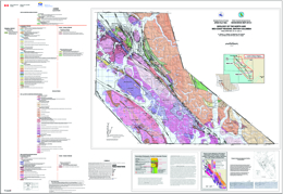
J. Nelson, L.J. Diakow, J.B. Mahoney, G.E. Gehrels, C.R. van Staal, S. Karl, M. Pecha, and J.J. Angen
Also published as Geological Survey of Canada Open File 7604
his set of two 1:150,000 sheets includes the westernmost Coast Mountains, the Inside Passage and surrounding islands between Porcher Island and Klemtu. The area is underlain by metamorphosed rocks of the Alexander terrane, which are intruded by eastward-younging Late Jurassic to Paleocene plutonic belts of the Coast Plutonic Complex. This work has subdivided the Alexander terrane in coastal northwestern British Columbia for the first time, and has demonstrated correlations with better-known exposures in southeastern Alaska and the St. Elias Range. It also assigns intrusive bodies to plutonic suites, based on new U-Pb geochronology.
Mapping between 2008 and 2012 was supported by the Natural Resources Canada Geoscience for Energy and Minerals Program, Multi-metals Northwest Cordillera Project (Geological Survey of Canada) and the British Columbia Geological Survey.
2011
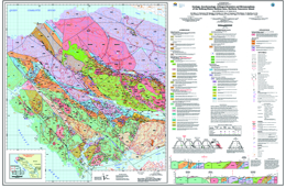
G.T. Nixon, J.L. Hammack, V.M. Koyanagi, L.D. Snyder, G.J. Payie, A. Panteleyev, N.W.D. Massey, J.V. Hamilton, A.J. Orr, R.M. Friedman, D.A. Archibald, J.W. Haggart, M.J. Orchard, E.T. Tozer, H.W. Tipper, T.P. Poulton, J. Palfy, and F. Cordey
Geoscience Map 2011-1 (1:50 000-scale) is the first in a series of five new geological maps (Geoscience Maps 2011-1 to 2011-5) of northern Vancouver Island which together provide a revised Early Mesozoic stratigraphic framework and Mesozoic-Tertiary plutonic history for southern Wrangellia. Geoscience Map 2011-1 describes the geology, geochronology, lithogeochemistry and metamorphism of the Holberg - Winter Harbour area (parts of NTS 092L/05, 12, 13; 102I/08, 09 and 16). The map area is underlain by a folded and faulted sequence of Late Triassic to Middle Jurassic volcanic and sedimentary rocks of the Vancouver and Bonanza groups intruded by granitoids of the Early to Middle Jurassic Island Plutonic Suite. The deformed Triassic-Jurassic rocks are unconformably overlain by Cretaceous marine clastics and cut locally by Tertiary dikes and minor intrusions. Middle Jurassic intrusions of the Island Plutonic Suite (e.g. Hushamu Creek and Goodspeed River plutons) are spatially and genetically associated with important calc-alkaline Cu-Au-Mo porphyry-style mineralization similar to the deposit at the former Island Copper mine, as well as coeval high-sulphidation, base- and precious-metal epithermal prospects hosted by rhyolitic flows and pyroclastic rocks in the Pemberton Hills – Mount McIntosh area. Major northwesterly-trending structures along Holberg Inlet and the Stranby River, the Holberg-Stranby fault system, separate well-mineralized, Middle Jurassic intrusions and the broadly coeval Holberg volcanic unit of the Bonanza Group from their Early Jurassic counterparts to the west. Radical changes in lowermost Jurassic stratigraphy are also evident across this structural corridor: a thick, predominantly subaerial, volcanic-volcaniclastic sequence (Le Mare Lake volcanic unit) west of the Holberg-Stranby faults largely correlates with a more condensed succession of intercalated, marine sedimentary and volcaniclastic strata (Nahwitti River siltstone-wacke unit) east and north of the fault zone. Regional metamorphism is generally characterized by very low-grade mineral assemblages (prehnite-pumpellyite to zeolite facies) except in the vicinity of faults and intrusive contacts where the rocks may reach upper greenschist to amphibolite grade, respectively.
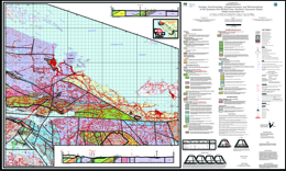
G.T. Nixon, J.L. Hammack, V.M. Koyanagi, G.J. Payie, A.J. Orr, J.W. Haggart, M.J. Orchard, E.T.Tozer, R.M. Friedman, D.A. Archibald, J. Palfy and F. Cordey
Geoscience Map 2011-2 (1:50 000-scale) is the second in a series of five new geological maps (Geoscience Maps 2011-1 to 2011-5) of northern Vancouver Island which together provide a revised Early Mesozoic stratigraphic framework and Mesozoic-Tertiary plutonic history for southern Wrangellia. Geoscience Map 2011-2 describes the geology, geochronology, lithogeochemistry and metamorphism of the Quatsino – Port McNeill area (NTS 092L/11 and parts of 092L/05, 12 and 13). The map area is underlain by a folded and faulted sequence of Late Triassic to Middle Jurassic volcanic and sedimentary rocks of the Vancouver and Bonanza groups intruded by granitoids of the Early to Middle Jurassic Island Plutonic Suite. The deformed Triassic-Jurassic rocks are unconformably overlain by Cretaceous marine clastics and cut locally by Tertiary dikes and minor intrusions. Middle Jurassic intrusions of the Island Plutonic Suite (e.g. Rupert Inlet Pluton) are spatially and genetically associated with important calc-alkaline Cu-Au-Mo porphyry-style mineralization at the former Island Copper mine, as well as coeval high-sulphidation, base- and precious-metal epithermal prospects hosted by rhyolitic flows and pyroclastic rocks in the Pemberton Hills – Mount McIntosh area to the west (Geoscience Map 2011-1).
Intriguingly, a dyke similar to the one associated with mineralization at Island Copper extends over 5 km east of the Rupert Inlet Pluton beneath a thick cover of glacial drift, as inferred from geophysical surveys, and remains to be drill-tested. A major, westerly-trending fault zone, the Holberg Fault, exposed in cliffs on the headland between Rupert and Holberg inlets, separates well-mineralized, Middle Jurassic intrusions and the largely coeval Holberg volcanic unit of the Bonanza Group from their Early Jurassic counterparts to the south. Radical changes in lowermost Jurassic stratigraphy are also evident across this structural corridor: a thick, predominantly subaerial, volcanic-volcaniclastic sequence (Le Mare Lake volcanic unit) south of the Holberg Fault largely correlates with a more condensed succession of intercalated, marine sedimentary and volcaniclastic strata north of the fault zone (Nahwitti River siltstone-wacke unit and lower part of the overlying Holberg volcanic unit). In the eastern part of the area, outliers of Neogene Alert Bay volcanic rocks rest unconformably on a downdropped block of Upper Cretaceous sedimentary strata of the Nanaimo Group. Regional metamorphism is generally characterized by very low-grade mineral assemblages (prehnite-pumpellyite to zeolite facies) except in the vicinity of faults and intrusive contacts where the rocks may reach upper greenschist to amphibolite grade, respectively.
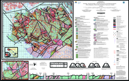
G.T. Nixon, J.L. Hammack, J.V. Hamilton, H. Jennings, J. P. Larocque, A.J. Orr, R.M. Friedman, D.A. Archibald, R.A. Creaser, M.J. Orchard, J.W. Haggart, H.W. Tipper, E.T. Tozer, F. Cordey and C.A. McRoberts
Geoscience Map 2011-3 (1:50 000-scale) is the third in a series of five new geological maps (Geoscience Maps 2011-1 to 2011-5) of northern Vancouver Island which together provide a revised Early Mesozoic stratigraphic framework and Mesozoic-Tertiary plutonic history for southern Wrangellia. Geoscience Map 2011-3 describes the geology, geochronology, lithogeochemistry and metamorphism of the Mahatta Creek area (NTS 092L/05). The map area is underlain by a folded and faulted sequence of Late Triassic to Middle Jurassic volcanic and sedimentary rocks of the Vancouver and Bonanza groups intruded by granitoids of the Early to Middle Jurassic Island Plutonic Suite. The deformed Triassic-Jurassic rocks are unconformably overlain by Cretaceous marine clastics and cut locally by Tertiary dikes. Of note stratigraphically is the radical change in thickness of the Late Triassic Quatsino limestone across the Mahatta Creek area from the west coast (~40 m thick) to the east (Neroutsos Inlet >900 m). A young Tertiary (Neogene) granodiorite, the Klaskish River Pluton, which is the founding member of the Late Miocene – Early Pliocene Klaskish Plutonic Suite, intrudes Late Triassic Karmutsen and Early Jurassic Bonanza (Le Mare Lake unit) volcanic rocks near the foot of the Brooks Peninsula. Recent exploration at the northern margin of this pluton has targeted a Cu-Mo porphyry system similar to mineralization at the former Island Copper mine hosted by a Middle Jurassic intrusion of the Island Plutonic Suite. Major northwesterly-trending faults with inferred vertical and/or stike-slip offsets occupy drift-filled valleys subparallel to the coast and appear to repeat Bonanza Group stratigraphy. One such fault system, the Le Mare Lake - Red Stripe Mountain faults, has demonstrably displaced stratigraphic units about 5 kilometres in a right-lateral sense. These structures are intersected by a set of steeply-dipping, northeasterly-trending, subparallel faults comprising the Brooks Peninsula Fault Zone, one of which (the Klaskish River Fault) cuts the Late Miocene Klaskish River Pluton. Regional metamorphism is generally characterized by very low-grade mineral assemblages (prehnite-pumpellyite to zeolite facies) except in the vicinity of faults and intrusive contacts where the rocks may reach upper greenschist to amphibolite grade, respectively.
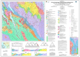
G.T. Nixon, L.D. Snyder, G.J. Payie, S. Long, A. Finnie, A.J. Orr, R.M. Friedman, D.A. Archibald, M.J. Orchard, E.T. Tozer, T.P. Poulton and J.W. Haggart
Geoscience Map 2011-4 (1:50 000-scale) is the fourth in a series of five new geological maps (Geoscience Maps 2011-1 to 2011-5) of northern Vancouver Island which together provide a revised Early Mesozoic stratigraphic framework and Mesozoic-Tertiary plutonic history for southern Wrangellia. Geoscience Map 2011-4 describes the geology, geochronology, lithogeochemistry and metamorphism of the Alice Lake area (NTS 092L/06 and part of 92L/03). The map area is underlain by a folded and faulted sequence of Late Triassic to Early Jurassic volcanic and sedimentary rocks of the Vancouver and Bonanza groups intruded by granitoids of the Early to Middle Jurassic Island Plutonic Suite. The deformed Triassic-Jurassic rocks are unconformably overlain by Cretaceous marine clastics and the eroded remnants of Tertiary (Neogene) volcanic edifices (Alert Bay volcanic unit). Intrusive counterparts of the Tertiary rocks include dikes and a granitoid pluton. The Late Triassic Quatsino limestone attains its maximum thickness (>900 m) and youngest age (Carnian to Early Norian) in the Alice Lake area. The limestone hosts significant base- and precious-metal skarn occurrences (e.g. the former Merry Widow and Old Sport mines) associated with Early Jurassic gabbroic and more leucocratic intrusions of the Island Plutonic Suite (Merry Widow Mountain Pluton). Skarn mineralization is also associated with the Early Pliocene Victoria Lake Pluton, the youngest member of the Late Miocene to Early Pliocene Klaskish Plutonic Suite. This composite pluton comprises an older granodiorite-porphyry phase (5.15 Ma) which has engulfed an enclave of Alert Bay volcanic rocks, and a younger quartz monzodiorite phase (4.6 Ma). Major structures in the area include steeply dipping, northerly and northwesterly-trending faults, and a younger intersecting set of northeasterly-trending structures related to the Brooks Peninsula Fault Zone. One such structure east of Neroutsos Inlet exhibits Early Pliocene or younger motion where it cuts the western margin of the Victoria Lake Pluton. Regional metamorphism is generally characterized by very low-grade mineral assemblages (prehnite-pumpellyite to zeolite facies) except in the vicinity of faults and intrusive contacts where the rocks may reach upper greenschist to amphibolite grade, respectively.
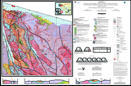
G.T. Nixon, M.C. Kelman, J.P. Larocque, D.B. Stevenson, L.A. Stokes, A. Pals, J. Styan, K.A. Johnston, R.M. Friedman, J.K. Mortensen, M.J. Orchard and C.A. McRoberts
Geoscience Map 2011-5 (1:50 000-scale) is the final map in a series of five new geological maps (Geoscience Maps 2011-1 to 2011-5) of northern Vancouver Island which together provide a revised Early Mesozoic stratigraphic framework and Mesozoic-Tertiary plutonic history for southern Wrangellia. Geoscience Map 2011-5 describes the geology, geochronology, lithogeochemistry and metamorphism of the Nimpkish – Telegraph Cove area (NTS 092L/07 and part of 92L/10). The map area is underlain by a folded and faulted sequence of Late Triassic volcanic and sedimentary rocks of the Vancouver and Bonanza groups intruded by granitoids of the Early to Middle Jurassic Island Plutonic Suite. The deformed Triassic rocks are unconformably overlain by Upper Cretaceous marine clastics (Nanaimo Group equivalents) and intruded by rare Tertiary dykes. The Late Triassic Quatsino limestone thins radically from west to east across the map area, reaching a maximum thickness of ~800 m between Nimpkish and Bonanza lakes and a minimum thickness of <250 m in coastal exposures west of Beaver Cove. Small base-metal skarn occurrences are concentrated between Bonanza and Nimpkish lakes where the limestone is thickest near contacts with Early-Middle Jurassic granitoid intrusions of the Island Plutonic Suite (e.g. northern margins of the Noomas Creek Pluton and Nimpkish Batholith west of Bonanza Lake). The underlying Karmutsen Formation has a minimum estimated thickness of ~6 km and comprises a basal submarine pillowed basalt unit (>3 km), a middle hyaloclastite unit (~1.5 km) and an upper subaerial flow unit (>1.5 km). This stratigraphy is well-exposed in oblique section along the east coast of the island between Telegraph Cove and Robson Bight. Younger augite-plagioclase-phyric volcanic sequences in the area are assigned to the Late Triassic Parson Bay Formation; Early to Middle Jurassic volcanic stratigraphy equivalent to the Le Mare Lake and Holberg volcanic units to the west and north, respectively, are entirely lacking. Major structures in the area include steeply dipping, northerly and northwesterly-trending faults (e.g. Huston Lake, Nimpkish and Bonanza Lake faults), and an intersecting set of northeasterly-oriented structures in the northernmost part of the map area. A major north-northwesterly-trending synclinal axis delineated by strata of the Parson Bay and Quatsino formations passes through the crest of the Hankin Range and extends northwards to the Beaver Cove Fault. Regional metamorphism is generally characterized by very low-grade mineral assemblages (prehnite-pumpellyite to zeolite facies) except in the vicinity of faults and intrusive contacts where the rocks may reach upper greenschist to amphibolite grade, respectively.
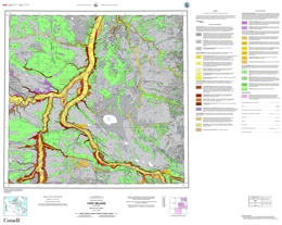
V. Levson and M. Fournier
Also published as Geological Survey of Canada Open File 5305.
Geoscience Map 2011-5 (1:100 000-scale) is a map which shows the surficial geology of the Fort Nelson area at a 1:100 000 scale. This map is an initiative of the Geological Survey of Canada, conducted as part of the Natural Resources Canada's Geomapping for Energy and Minerals (GEM) program.
2010
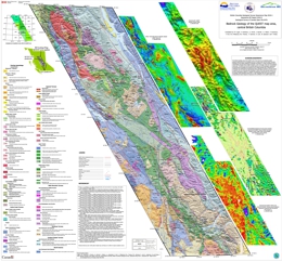
J.M. Logan, P. Schiarizza, L.C. Struik, C. Barnett, J.L. Nelson, P. Kowalczyk, F. Ferri, M.G. Mihalynuk, M.D. Thomas, P. Gammon, R. Lett, W. Jackaman and T. Ferbey
Also published as GSC Open File 6476/GBC Report 2010-5
The British Columbia Geological Survey, Geoscience BC and Natural Resources Canada - Geological Survey of Canada have collaborated to update the BC Geology Map (the Province's digital geology map) in central BC. The update area corresponds to Geoscience BC’s QUEST Project geophysical survey footprint, which extends from Williams Lake to Mackenzie (an area larger than Vancouver Island).
The revised geology for this region has been generated by geological, geophysical and geochemical experts from the three organizations. The project incorporates geophysical and geochemical data from Geoscience BC’s QUEST Project, geophysical data from Natural Resources Canada and recent bedrock mapping by the British Columbia Geological Survey. The BC Geology Map QUEST Area update focuses on the volcanic and intrusive rocks of the Quesnel Terrane in central British Columbia, which are prospective for copper and gold deposits but covered by glacial deposits in the center of the update area. New interpretations are expected to benefit to the mineral exploration community working in the region.
Additionally, a draft copy of the digital BC GeologyMap, updated to include new information from the Bedrock Geology of the QUEST area map, is available for download.
About BC Geology Map
The BC Geology Map is British Columbia’s online digital geology map, maintained by the British Columbia Geological Survey. The map was originally compiled from geological maps by British Columbia Geological Survey, Geological Survey of Canada, university and industry geologists.
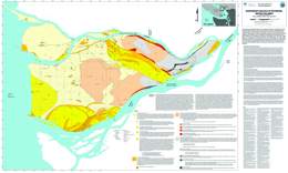
P.A. Monahan, V.M. Levson and B. Kerr
This map shows geological variation in the Quarternary deposits underlying the City of Richmond, British Columbia, and has been prepared as part of an earthquake hazard mapping project in the city. Richmond is located in one of the most seismically active regions in Canada (Rogers, 1998), and the deltaic sediments on which the city is built can amplify ground motions and are susceptible to earthquake induced liquefaction (e.g. Byrne, 1978; Finn et al., 1989; Byrne and Anderson, 1991; Clague et al., 1992, 1997, 1998b; Watts et al., 1992; Rogers et al., 1998; Harris et al., 1995, 1998; Cassidy et al., 1997; Cassidy and Rogers, 1999; Levson and Monahan, 2004). Because the variation in earthquake hazards is most affected by geological conditions in the upper 20 to 30 metres, this map primarily reflects geological variation in the upper 20 to 30 metres of the Quaternary sequence.
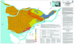
P.A. Monahan, V.M. Levson and B. Kerr
The City of Richmond, British Columbia, is located in one of the most seismically active regions in Canada (Rogers, 1998). The effects of earthquakes are not only dependent upon the magnitude of the earthquake and the distance from the source, but can vary considerably due to local geological conditions. These conditions can be mapped using existing geological and geotechnical data. This map shows the variation in the earthquake-induced liquefaction hazard in the City of Richmond, BC. The city is located entirely within the modern Fraser River delta, and the deltaic sediments on which the city is built are particularly susceptible to earthquake induced liquefaction (e.g. Byrne, 1978; Finn et al., 1989; Byrne and Anderson, 1991; Clague et al., 1992, 1997, 1998b; Watts et al., 1992). This map has been prepared as part of an earthquake hazard mapping project in the city. An accompanying map shows the Quaternary geology of the Richmond area (Geoscience Map 2010-2).
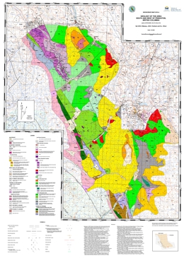
N.W.D. Massey, J.M.S. Vineham and S.L. Oliver
The map covers an area centred about 15 km to the southwest of Princeton. The map area stretches from the Copper Mountain and Wolfe Creek area southwest to East Gate and the boundary of Manning Park and northwest to the Tulameen River.
The map area lies at the western edge of Quesnellia and includes some of the southernmost exposures of the late Triassic Nicola Group. To the east of the Boundary Fault, rocks of the Nicola group are assigned to the “Eastern Belt” (Preto 1979; Mortimer 1987). Interbedded black argillites, grey siltstones and sandstones are overlain by volcanic and volcaniclastic rocks of the Wolfe Creek Formation, which display an alkalic affinity. They host the important porphyry and skarn deposits of the Copper Mountain area (Preto, 1972).
To the west, rocks of the Nicola Group were included in the calc-alkaline “western belt” by Mortimer (1987). They are lithologically similar to those in the east, though differing in details of stratigraphic succession. Clastic sedimentary rocks, dominated by black argillites, are intercalated with feldspathic tuffs and tuffaceous sediments. These pass westwards, and probably upwards, into typical Nicola pyroxene-feldspar tuffs, lapilli tuffs and breccias. A sequence of massive feldspar basalt and greenstone flows occurs in the area southeast of the Granite Creek campsite. The volcanic rocks become more deformed to the west, the change from massive to schistose rocks being transitional and gradual from east to west as foliation becomes progressively more penetrative and steeper. Both schistose metasediments and metavolcanic rocks occur in the aureole of the Jurassic to Cretaceous Eagle Plutonic Complex along the western margin of the map area.
The Late Triassic Tulameen Ultramafic-Gabbro Complex is structurally emplaced into, though probably coeval with, the Nicola Group. Several smaller bodies of diorite-gabbro or pyroxenite also occur in the map area. The Tulameen Complex is host to chromite±Pt, magnetite, and copper deposits and an important source of platinum and gold-platinum placers of the area.
In the west of the map area, rocks of the Eastgate-Whipsaw metamorphic belt have been correlated with the Nicola by Rice (1947) and Monger (1989). The belt is bound by the syntectonic Eagle Plutonic Complex to the west and the Similkameen fault to the east. The belt shows significant lithological differences to the immediately adjacent Nicola volcanic rocks. It can be divided it into three northwest trending lithological assemblages that show increasing metamorphic grade from greenschist in the east to amphibolite in the west. The belt is host to VMS mineralization (e.g. Red Star and S&M group), as well as porphyry-Cu style mineralization associated with the Whipsaw porphyry. The belt may, in part, be equivalent to the Late Permian to Early Triassic Sitlika-Kutcho sequences, although preliminary zircon geochronometry suggests an Early Permian age (Oliver, work in progress).
Volcanic and sedimentary rocks of the Eocene Princeton Group occur in the northern (Tulameen coal basin), central (Princeton basin) and eastern parts of the map area. They lie unconformably on the Nicola Group and all older intrusive rocks. Comagmatic minor intrusions occur throughout the map area, particularly to the east of the Boundary fault.
2009
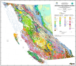
P. Erdmer and Y. Cui
Geoscience Map 2009-1 is a print-ready, one-sheet geological map of British Columbia. It summarizes the bedrock geology at scales of 1:2,000,000 and 1:1,500,000. This map was compiled from geological maps by the British Columbia Geological Survey, Geological Survey of Canada, and university and industry geologists.
View Geoscience Map 2009-01 (1:1,500,000 PDF, 275.3 MB)
Download Geoscience Map 2009-01 (1:1,500,000 and 1:2,000,000. ZIP, 387 MB)
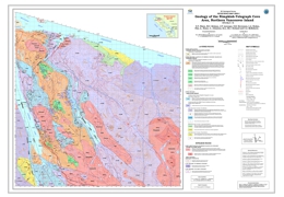
G.T. Nixon, M.C. Kelman, J.P. Larocque, D.B. Stevenson, L.A. Stokes, A. Pals, J. Styan, K.A. Johnston, M.J. Orchard and C.A. McRoberts
Geoscience Map 2009-02 (1:50,000) describes the bedrock geology of the Nimpkish-Telegraph Cove area of northern Vancouver Island (NTS 092L/7, 10). The map complements Geoscience Maps 2006-01 to -04 showing the geology of the Quatsino Sound area to the northwest and supercedes Open File Map 2006-5. The map area is underlain by a folded and faulted sequence of Triassic volcanic and sedimentary rocks of the Vancouver and Bonanza groups intruded by granitoids of the Early to Middle Jurassic Island Plutonic Suite. The latter intrusions are associated with important calc-alkaline Cu-Mo-Au porphyry, base- and precious-metal skarn and rare, manto-type massive sulphide occurrences. The deformed Triassic-Jurassic rocks are unconformably overlain by Late Cretaceous marine clastics equivalent in part to the Nanaimo Group. Minor intrusions include subvolcanic dikes and sills comagmatic with volcanic strata of the Karmutsen Formation and Bonanza Group, granitoids of the Island Plutonic Suite and a Tertiary dike possibly related to the Neogene Alert Bay volcanic unit to the north.
2008
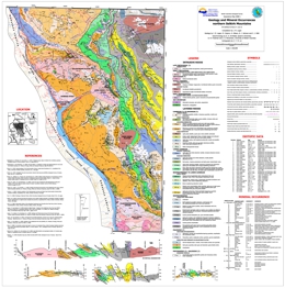
J.M. Logan, M. Colpron, G. Gibson, B.J. Johnson and C.J. Wild
Geoscience Map 2008-01 presents a 1:100,000-scale geology map in the northern Selkirk Mountains.
The Selkirk Mountains straddle the boundary between rocks assigned to the North American miogeocline and the pericratonic Kootenay Terrane. Lower Paleozoic rocks of the northern Selkirk Mountains host numerous volcanogenic massive sulphide occurrences, that include the Goldstream copper-zinc mine, which produced 78 270 tonnes of copper and 8 000 tonnes of zinc from 2 221 228 tonnes milled until shut down in January, 1996 and the arsenical, gold-rich J&L deposit which has probable and possible reserves in excess of 5 million tonnes averaging 2.71 % Pb, 4.33 % Zn, 7.23 g/t Au and 72 g/t Ag. The stratiform nature of these deposits makes understanding the regional stratigraphic and structural setting fundamental to exploration for new VHMS deposits.
This 1:100,000 scale colour compilation map is based on fieldwork conducted between 1994 and 1996, compilation of 3 previously published 1:50,000 scale Open file maps as well as mineral exploration assessment reports. It covers approximately 2200 km2 of the northern Selkirk Mountains in the area that extends from the northern boundary of Mount Revelstoke National Park to the head waters of French Creek and from the headwaters of Goldstream River and Downie Creek west to Revelstoke Lake.
This map presents new geochronology, palaeontology, updated mineral occurrences and prospective exploration targets (exhalative horizons) to aid exploration for base metal deposits in this region.
2007
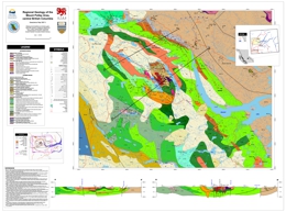
J.M. Logan, A.B. Bath, M.G. Mihalynuk, and C.J. Rees
Geochronology by T. D. Ullrich and R. Friedman.
Geoscience Map 2007-1 presents a 1:50 000-scale geology map of the Mount Polley area. This geological map provides new insight into the geology, geochronology and mineral potential of the Nicola Arc in the Quesnel Lake region of central British Columbia. It presents the results of new mapping and compilation of University and private industry research designed to document the geologic and metallogenic evolution and architecture across this part of the Quesnel terrane.
Cu-Au±Ag porphyry and propylitic Au replacement associated with alkaline intrusive centres at the Mount Polley mine and the QR mine, respectively, comprise important exploration models for this part of the Nicola Arc. Delineation of additional reserves and new exploration targets by Imperial Metals Corporation and Cross Lake Minerals Ltd. at Mount Polley and QR mines underlines the potential for new discoveries and mines in correlative rocks in the area.
The Mount Polley survey was delivered through support from Geoscience BC and a Geoscience partnership developed between Abacus Mining and Exploration, Imperial Metals Corporation and Nova Gold Corporation to study British Columbian alkaline porphyry copper-gold deposits.
2006
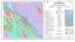
G.T. Nixon, L.D. Snyder, G.J. Payie, S. Long, A. Finnie, R.M. Friedman, D.A. Archibald, M.J. Orchard, T. Tozer, T.P. Poulton and J.W. Haggart
The British Columbia Geological Survey has completed extensive geological mapping and mineral deposits studies on northern Vancouver Island over the last several years. This is an ongoing program of mapping and mineral deposits studies. Northern Vancouver Island, and particularly the Quatsino Sound area, is richly endowed in mineral occurrences, has had a successful mining history, such as the former Island Copper mine (092L 158). The region also has numerous mineral occurrences, some of which are under-explored but with excellent potential. The release of these three 1:50 000-scale Geoscience Maps covers an area extending from Winter Harbour - San Josef Bay on the west coast to Port Hardy - Port McNeill on the east coast, an area encompassing NTS sheets 102I/8, 9 and 92L/6, 11, and 12. Geoscience Map 2006-1 covers the Alice Lake area, 092L/6.
The area is underlain by a folded and faulted sequence of Upper Triassic to Middle Jurassic volcanic and sedimentary rocks of the Vancouver and Bonanza Groups intruded by granitoids of the Island Plutonic suite. The latter rocks are associated with important calcalkaline Cu-Mo-Au porphyry, and base and precious-metal skarn and epithermal mineral occurrences. Cretaceous marine clastic and Tertiary volcanic-sedimentary strata with lower mineral potential overlie the Triassic-Jurassic rocks.
These geoscience maps provide a new stratigraphic framework for the Early Mesozoic sequences, calibrated by 40Ar/39Ar and U-Pb isotopic dating and macrofossil and microfossil (conodont and radiolarian) faunas. The Bonanza group now includes the Upper Triassic Parson Bay Formation, which contains mapable volcanic/volcaniclastic horizons, overlain by unnamed volcaniclastic-sedimentary strata of uppermost Triassic to lowermost Jurassic age, in turn succeeded by Lower to Middle Jurassic, predominantly volcanic and volcaniclastic sequences of the informally named LeMare Lake volcanics, formerly "Bonanza volcanics". The latter term is usefully retained for all volcanic lithologies within the Bonanza Group, which spans some 40 million years of magmatic arc evolution from the Late Triassic (Carnian) to the Middle Jurassic (Bajocian).
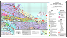
G.T. Nixon, J.L. Hammack, V.M. Koyanagi, G.J. Payie, J.W. Haggart, M.J. Orchard, T. Tozer, D.A. Archibald, R.M. Friedman, J. Palfy and F. Cordey
The British Columbia Geological Survey has completed extensive geological mapping and mineral deposits studies on northern Vancouver Island over the last several years. This is an ongoing program of mapping and mineral deposits studies. Northern Vancouver Island, and particularly the Quatsino Sound area, is richly endowed in mineral occurrences, has had a successful mining history, such as the former Island Copper mine (092L 158). The region also has numerous mineral occurrences, some of which are under-explored but with excellent potential. The release of these three 1:50 000-scale Geoscience Maps covers an area extending from Winter Harbour - San Josef Bay on the west coast to Port Hardy - Port McNeill on the east coast, an area encompassing NTS sheets 102I/8, 9 and 92L/6, 11, and 12. Geoscience Map 2006-2 covers the Quatsino - Port McNeill area, 092L/11, 12E.
The area is underlain by a folded and faulted sequence of Upper Triassic to Middle Jurassic volcanic and sedimentary rocks of the Vancouver and Bonanza Groups intruded by granitoids of the Island Plutonic suite. The latter rocks are associated with important calcalkaline Cu-Mo-Au porphyry, and base and precious-metal skarn and epithermal mineral occurrences. Cretaceous marine clastic and Tertiary volcanic-sedimentary strata with lower mineral potential overlie the Triassic-Jurassic rocks.
These geoscience maps provide a new stratigraphic framework for the Early Mesozoic sequences, calibrated by 40Ar/39Ar and U-Pb isotopic dating and macrofossil and microfossil (conodont and radiolarian) faunas. The Bonanza group now includes the Upper Triassic Parson Bay Formation, which contains mapable volcanic/volcaniclastic horizons, overlain by unnamed volcaniclastic-sedimentary strata of uppermost Triassic to lowermost Jurassic age, in turn succeeded by Lower to Middle Jurassic, predominantly volcanic and volcaniclastic sequences of the informally named LeMare Lake volcanics, formerly "Bonanza volcanics". The latter term is usefully retained for all volcanic lithologies within the Bonanza Group, which spans some 40 million years of magmatic arc evolution from the Late Triassic (Carnian) to the Middle Jurassic (Bajocian).
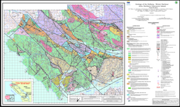
G.T. Nixon, J.L. Hammack, V.M. Koyanagi, G.J. Payie, L.D. Snyder, A. Panteleyev, N.W.D. Massey, D.A. Archibald, J.W. Haggart, M.J. Orchard, R.M. Friedman, T. Tozer, H.W. Tipper, T.P. Poulton, J. Palfy, F. Cordey and D.J. Barron
The British Columbia Geological Survey has completed extensive geological mapping and mineral deposits studies on northern Vancouver Island over the last several years. This is an ongoing program of mapping and mineral deposits studies. Northern Vancouver Island, and particularly the Quatsino Sound area, is richly endowed in mineral occurrences, has had a successful mining history, such as the former Island Copper mine (092L 158). The region also has numerous mineral occurrences, some of which are under-explored but with excellent potential. The release of these three 1:50 000-scale Geoscience Maps covers an area extending from Winter Harbour - San Josef Bay on the west coast to Port Hardy - Port McNeill on the east coast, an area encompassing NTS sheets 102I/8, 9 and 92L/6, 11, and 12. Geoscience Map 2006-3 covers the Holberg - Winter Harbour area, 092L/12W, 102I/8, 9.
The area is underlain by a folded and faulted sequence of Upper Triassic to Middle Jurassic volcanic and sedimentary rocks of the Vancouver and Bonanza Groups intruded by granitoids of the Island Plutonic suite. The latter rocks are associated with important calcalkaline Cu-Mo-Au porphyry, and base and precious-metal skarn and epithermal mineral occurrences. Cretaceous marine clastic and Tertiary volcanic-sedimentary strata with lower mineral potential overlie the Triassic-Jurassic rocks.
These geoscience maps provide a new stratigraphic framework for the Early Mesozoic sequences, calibrated by 40Ar/39Ar and U-Pb isotopic dating and macrofossil and microfossil (conodont and radiolarian) faunas. The Bonanza group now includes the Upper Triassic Parson Bay Formation, which contains mapable volcanic/volcaniclastic horizons, overlain by unnamed volcaniclastic-sedimentary strata of uppermost Triassic to lowermost Jurassic age, in turn succeeded by Lower to Middle Jurassic, predominantly volcanic and volcaniclastic sequences of the informally named LeMare Lake volcanics, formerly "Bonanza volcanics". The latter term is usefully retained for all volcanic lithologies within the Bonanza Group, which spans some 40 million years of magmatic arc evolution from the Late Triassic (Carnian) to the Middle Jurassic (Bajocian).
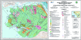
G.T. Nixon, J.L. Hammack, J.V. Hamilton, H. Jennings, J. Larocque, M.J. Orchard, J.W. Haggart, H.W. Tipper, R.M. Friedman, D.A. Archibald, F. Cordey and K.A. Johnston
The British Columbia Geological Survey has completed extensive geological mapping (1:50 000-scale) and mineral deposits studies on northern Vancouver Island over the recent past. Northern Vancouver Island, and particularly the Quatsino Sound area, is richly endowed in mineral occurrences and has had a successful mining history, highlighted by the former Island Copper mine (MINFILE 092L 158). To date, most mining exploration has focussed on the numerous mineral occurrences in the Jurassic Bonanza Group and comagmatic Island Plutonic Suite. The Late Triassic flood basalt province (Karmutsen Formation) and newly discovered Tertiary plutons are under-explored, but have excellent potential. The Mahatta Creek Geoscience Map complements previously released maps (2006-1 to 2006-3) which together cover an area extending from the Brooks Peninsula - San Josef Bay on the west coast to Port Hardy - Port McNeill on the east coast (NTS sheets 102I/8,9 and 92L/5, 6, 11 and 12).
Geoscience Map 2006-4 covers the Mahatta Creek area (NTS 092L/5). The region is underlain by a folded and faulted sequence of Late Triassic to Middle Jurassic volcanic and sedimentary rocks of the Vancouver and Bonanza groups intruded by granitoids of the Early to Middle Jurassic Island Plutonic Suite. The latter intrusions are associated with important calc-alkaline Cu-Mo-Au porphyry, base- and precious-metal skarn and epithermal mineral occurrences. The folded Triassic-Jurassic succession is overlain unconformably by Cretaceous marine clastics equivalent to rocks of the Kyuquot, Queen Charlotte and Nanaimo groups which are exposed elsewhere on Vancouver Island and in the Queen Charlotte Islands. These strata are succeeded by Tertiary (Neogene) volcanic and-sedimentary rocks of the Alert Bay volcanic belt. Recently recognized granitoid plutons of Miocene-Pliocene age, the Klaskish Plutonic Suite, appear to be confined to the Brooks Peninsula fault zone and represent intrusive equivalents of the Alert Bay volcanic rocks. The Mahatta Creek and previously published geoscience maps provide a new stratigraphic framework for the Early Mesozoic strata, calibrated by 40Ar/39Ar and U-Pb isotopic dating and macrofossil and microfossil (conodont and radiolarian) faunas. The Bonanza Group now includes the Late Triassic Parson Bay Formation, which contains mappable volcanic-volcaniclastic horizons and is overlain by unnamed volcaniclastic-sedimentary strata of latest Triassic (Rhaetian) to lowermost Jurassic (Hettangian) age. These strata are succeeded by Early (Hettangian) to Middle (Bajocian) Jurassic, predominantly volcanic and volcaniclastic sequences of the informally named LeMare Lake volcanic unit, formerly known as the "Bonanza volcanics". The latter term may be usefully retained to informally refer to all the volcanic rocks within the Bonanza Group, as presently defined.
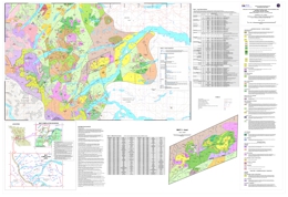
L.J. Diakow
1 sheet at 1:150,000 scale
This geological compilation covers approximately six, 1:50 000-scale map sheets adjacent to the Coast Belt-Intermontane Belt boundary within the Whitesail Lake map area. The map is based on a compilation of geological mapping conducted by the BC Geological Survey during the Whitesail Project (1987-1990), as well as data available in previously published government reports and university theses. The area is underlain by a diverse assemblage of Late Paleozoic to Cenozoic volcanic, sedimentary and metamorphic rocks, together with numerous plutonic rocks.
The map features a collation of available fossil collections and age determinations. It also contains a mineral occurrence database that demonstrates a strong spatial relationship between Cu-Mo mineralization and hornblende-biotite-bearing intermediate intrusions of the Late Cretaceous and Eocene suites.
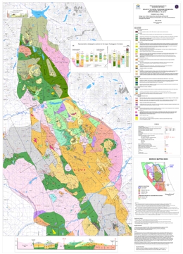
L.J. Diakow, G. Nixon, R. Rhodes and P. van Bui
1 sheet at 1:50,000 scale
Contribution to the Toodoggone Targeted Geoscience Initiative II - Mining Company Partnership
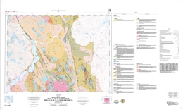
This geological map is the result of a 1:20 000-scale bedrock mapping program conducted from 2003 to 2005 as part of a partnership between the BC Geological Survey and Stealth Minerals Ltd., Northgate Exploration Ltd., Finlay Minerals Ltd., Bishop Resources Inc., Sable Resources Ltd., the Geological Survey of Canada, and the University of British Columbia.
This map covers approximately 900 km2 of mountainous terrain between the Finlay River and Chukachida Lake, and extends the detailed map coverage at 1:20 000-scale farther to the north beyond published BCGS Geoscience Map 2001-1, centred on the Kemess South Au-Cu porphyry mine. It portrays an updated and revised stratigraphy for the Early Jurassic Toodoggone Formation and comagmatic plutons of the Black Lake intrusive suite. The Toodoggone Formation in the map area is largely composed of a previously unrecognized stratigraphic succession that is subdivided into 4 new units (i.e., Belle, Pillar, Graves and Junkers). These units consist mainly of subaerial basalt to rhyolite volcanic rocks and derived sedimentary rocks that were deposited between 194 Ma and 186 Ma. They overlie the previously defined, pre-194 to 200Ma Toodoggone Formation, and older Late Triassic basement and occur above an erosional unconformity.
Regionally the Toodoggone Formation is noted for numerous epithermal precious metal occurrences and quartz monzonite to monzonite plutons of the Black Lake intrusive suite locally host Au-Cu porphyry mineralization. Copper-magnetite skarns are locally developed within Early Permian limestones of the Asitka Group crosscut by Early Jurassic plutons.
J.W. Haggart, L.J. Diakow, J.B. Mahoney, G.J. Woodsworth, L.C. Struik, S.M Gordee, S. Israel, R.L. Hooper, P. van der Heyden, M. Rusmore, R.E. Lett, M. Ceh, N.L. Hastings and C. Wagner
This publication supersedes BCGS Open File 2004-13 and GSC Open File 4639.
Also published as Geological Survey of Canada Open File 5410
Geoscience Map 2006-7 is a compilation of 1:100 000-scale geological maps and supporting data tables for the eastern part of the Bella Coola map-area and adjacent regions in west-central British Columbia. The compilation encompasses more than 12 000 km² and straddles the boundary between the Intermontane and Coast Belt geomorphologic provinces. Geological mapping and data collection for the various maps on the CD was undertaken under different programs, including the Bella Coola Targeted Geoscience Initiative (TGI) Project, the British Columbia Rocks to Riches Program, and Cordilleran Energy and Minerals Project (Y15), administered by the Geological Survey of Canada.
The Bella Coola TGI Project was a jointly funded mapping program undertaken during the period 2000-2003 between the Geological Survey of Canada (GSC) and the British Columbia Geological Survey (BCGS). Additional support was provided by the University of Wisconsin–Eau Claire (UWEC) and the Pacfic Centre for Isotopic and Geochemical Research (PCIGR) at the University of British Columbia (UBC). The objective of the Bella Coola TGI project was to update the geology in the region around Bella Coola, with the goals of unraveling the region’s complex geological history and assessing prospective rock sequences for volcanogenic massive sulphide and copper porphyry potential.
As a result of favourable mineralization results obtained in the more northerly parts of the TGI project, subsequent geological mapping was authorized in southern Whitesail Lake map-area (93E) under the British Columbia Rocks to Riches program during 2003 and 2004. This project included funding from the province of British Columbia as well as the GSC, the UWEC, and the PCIGR. Regional mapping at 1:50 000-scale carried out under this program adjoins the results of the Bella Coola mapping program.
2005
T. Höy
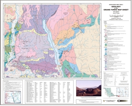
The 1:50 000-scale geology map is a result of the BC and Yukon Chamber of Mines' Rocks to Riches Program which is supporting geological mapping and deposit studies in the Grand Forks map sheet area.
Superceded by Geoscience Map 2009-01
N.W.D. Massey, D.G. MacIntyre, P.J. Desjardins and R.T. Cooney
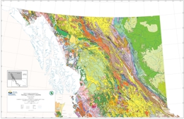
This compilation map is a digital release from which a “hardcopy” printed version can be produced. It is a companion to Open File 2005-2 “The Digital Geology of British Columbia” which was released on DVD in January 2005. This is the first compilation of the province’s geology produced by the BC Geological Survey since 1977 and incorporates much of the new geoscience mapping and research by Ministry geoscientists and others, which has been completed during the past 25 years.
This geology map has been prepared at 1:1,000,000-scale and is comprised of three sheets (2 geology maps - North and South, plus a legend).
See also Geoscience Map 2009-01: Geological Map of British Columbia by P. Erdmer and Y. Cui
Geoscience Map 2005-3 is a digital, cartographic version of British Columbia geology. It can be used and distributed as a digital product and/or printed as a cartographically correct rendition of the geology of British Columbia:
2004
T. Höy; cartography by W. Jackaman
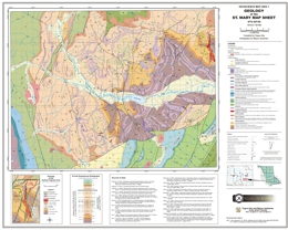
This geological map shows: the subdivision of the Lower Aldridge, distribution of the Lower Aldridge - Middle Aldridge contact, the Sullivan horizon, and distribution of key marker units within the Middle Aldridge. The St. Mary map area (1:50,000-scale) is underlain mainly by Middle Proterozoic Aldridge Formation and younger overlying Purcell Supergroup rocks. The world-class Sullivan, sedex Cu-Pb-Zn deposit is located within the Aldridge Formation, along the eastern edge of the map sheet. Numerous base metal and precious metal veins, stratiform base-metal occurrences, and pegmatites of the Hellroaring Creek stock are located farther west.
GIS files for download, including Manifold MAP, ESRI Shape and KML files, are available in GeoFile 2007-02, Belt-Purcell Metallogenic Data and Map by D.G. MacIntyre.
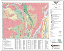
T. Höy and K.P.E. Dunne; cartography by W. Jackaman
The Nelson map area (1:50,000) straddles the boundaries between rocks of North America, Kootenay Terrane and Quesnellia. It is along the southern part of the Kootenay Arc, a north-trending structural zone that has been extensively explored for Cambrian-hosted lead-zinc deposits. A large variety of mineral occurrences are found on the sheet, including the Kena porphyry gold system and numerous precious metal veins of the Nelson district. A considerable part of the area is underlain by the Early Jurassic Rossland Group, host to the gold-copper vein system at Rossland farther west.
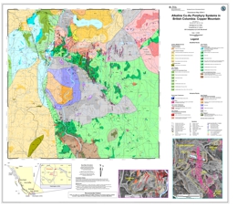
geology by V.A. Preto; compiled by G.T. Nixon; GIS cartography by E.A.M Macdonald
This 1:50 000-scale geological map covers the area immediate to the Copper Mountain deposits and provides new information on the geological setting of an important copper-gold deposit in BC. Recent increases in the price of base and precious metals has generated renewed interest in exploration for Cordilleran Cu-Au porphyry deposits, which have produced major metal mines in British Columbia. Geoscience Map 2004-3 provides a new compilation of the geology of the Copper Mountain mining camp, an important past-producer, as originally described by Preto (1972) and Montgomery (1967). This new release captures the geological setting of the Cu-Au ores and surrounding prospects, and incorporates new and revised isotopic age dates for rocks associated with the mineralization.
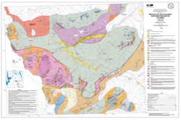
C. Ash; original accompanies Bulletin 94 by C. Ash
The 1:25 000-scale geology map of the historic Atlin placer camp, which was initially published as a supplement to Bulletin 94 (Ash, 1994), has been digitally re-mastered. The geology has been coloured and referenced to the NAD83 TRIM topographic base. Additionally, the distribution of known placer deposits (Levson & Kerr, 1992) has been added to the geological basemap. These revisions are timely and should prove to be of assistance to anyone participating in activity within the Atlin gold camp.
2003
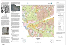
V.M. Levson, D.E. Kerr. C. Lowe and H. Blyth
Also published as GSC Open File 1562
Scale 1:50,000
This surficial geology and placer potential map of the Atlin area was originally produced by the British Columbia Geological Survey (Levson and Kerr, 1992) following a 1991 field program investigating the geology of placer gold deposits in the Atlin mining district (Levson, 1992). This Map is an updated colour version of the map presented by Levson and Kerr (1992) and includes results of new work conducted under the Atlin Targeted Geoscience Initiative by the British Columbia Geological Survey and the Geological Survey of Canada. New data includes recently published research on the Quaternary geology of the area (Levson and Blyth, 2001), new field observations and geochemical data on platinum in placer deposits (Levson et al., 2002), and a digital elevation model of the region produced by Lowe et al. (2001; Figure 1). Map units have been revised to include the chrono-stratigraphic designations as well as surficial materials information but unit boundaries have not been altered.
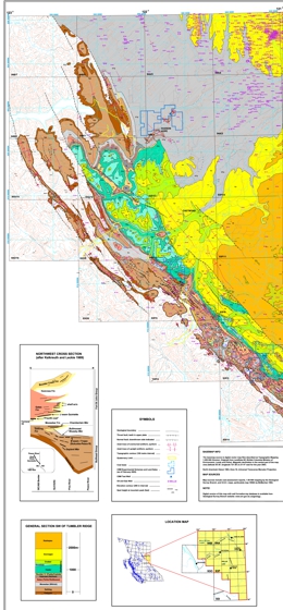
A.S. Legun
This Geoscience File consists of a map at a 1:200 000 scale covering the Peace River District south of latitude 56 30' (NTS topo sheets 93P and parts of 93I, 93O, 94A and B). The map covers the surface geology of the Peace River coalfield and areas to the east where coal measures form a subsurface CBM resource. Outlined on the map are CBM land sales, experimental schemes, as well as coal leases. The digital file includes additional layers showing the distribution of coal boreholes, isoreflectance contours for the Gething Formation (from Marchioni and Kalkreuth 1992). A coal borehole database (Coalbh_nad83) is included on floppy disk in dbf and csv format.
The surface geology map draws on numerous assessment reports and the mapping results of federal and provincial programs in the 1980s and 1990s. It updates the 1978 compilation of the surface geology of the Peace River coalfield and provides a current geologic base for regional exploration planning.
A digital database of well formation-tops (Tops_map.dbf) supports the map. The database is a subset of larger datasets maintained by the Oil and Gas Commission (http://www.bcogc.ca). The database is a compilation of stratigraphic log picks by various petroleum company geologists over the years. As such it is not standardized, but does provide a first approximation of depths to important stratigraphic markers in the coal-bearing Lower Cretaceous sequence. It can be used together with other databases (e.g. coal borehole and coal reflectance databases) available from federal and provincial archives to assess CBM potential.
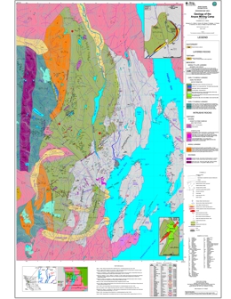
D.J. Alldrick
This Geoscience File consists of a map at a 1:200,000 scale covering the Anyox Mining Camp.
2002
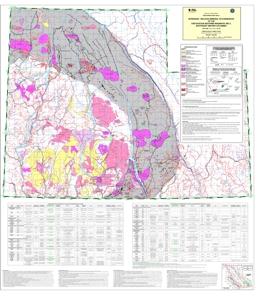
compilation by J. Logan; geological cartography by J. Logan and V. Vilkos
This map was generated from digital geological compilations of the Kootenay Mineral Assessment (Höy et al., 1994) and the East Part of the Okanagan Mineral Assessment (Schiarizza and Church, 1996). Modifications incorporate age determinations and more recent mapping associated with the Intrusive-related gold deposits project (1999-2001) and references within.
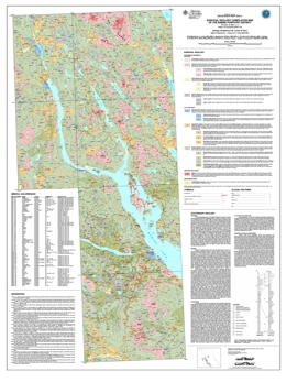
geology compiled by V.M. Levson; Digital Cartography by J. Dubois and T. Ferbey
This surficial geology map of the Babine Porphyry District is a compilation following on the work of several authors from 1972 to 1998. A Bedrock geology compilation map of the Babine porphyry district was completed by MacIntrye (Open File 2001-3). This is also referenced as Figure 2, to accompany Bulletin 110.
P. Schiarizza, J. Riddell, R.G. Gaba, D.M. Melville, P.J. Umhoefer, M.J. Robinson, B.K. Jennings and D. Hick
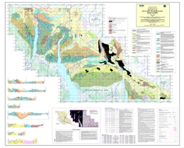
Geoscience Map 2002-03 covers an area of about 2000 square kilometres in southwestern BC, and encompasses the transition from the Chilcotin and Niut ranges of the Coast Mountains to the subdued topography of the Chilcotin Plateau. The area is underlain by Late Paleozoic through Middle Jurassic sedimentary, volcanic and plutonic rocks of the Bridge River, Cadwallader, Methow and Stikine terranes, together with Jura-Cretaceous sedimentary rocks of the Tyaughton-Methow basin, Late Cretaceous subaerial volcanic rocks of the Powell Creek formation, and Miocene-Pliocene plateau lavas of the Chilcotin Group. The area also includes important suites of Late Cretaceous granitoid intrusions, and important regional structures such as the Yalakom and Tchaikazan dextral strike-slip faults. The map includes new geological information from around the Late Cretaceous Fish Lake (Prosperity) copper-gold porphyry deposit, the Eocene Skinner gold-quartz vein deposit and several porphyry-style copper-gold occurrences associated with Late Triassic tonalite intrusions of the Cadwallader terrane.
B.N. Church
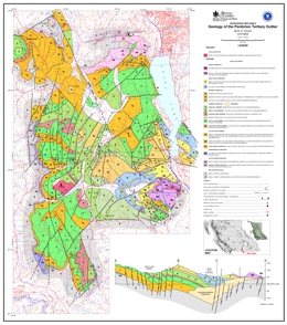
The Penticton Tertiary outlier is characterized by low mountainous terrain bounded by the Okanagan valley on the east (elev.~350 m) and the Similkameen and tributary valleys on the west (elev.~550 m). From the White Lake basin (elev. ~ 530 m), in the east-central part of the Penticton outlier, slopes rise gently to an almost complete ring of hills that includes Mount Orofino (elev. 1590 m) to the southwest. The concordant summits northwest and southwest of White Lake are a remnant of a once continuous upland surface that comprises the southern extremity of the Thompson Plateau.
The principal mineral resources in the Penticton Outlier are the Dust Mac mine (MINFILE No. 082ESW078) near Okanagan Falls that produced 93 000 tonnes of gold-silver ore from 1975 to 1977 and the Vault prospect (MINFILE No. 082ESW173) west of Skaha Lake containing an estimate gold reserve of 200 000 oz.
In the Okanagan - Boundary region the early Tertiary continental sedimentary and volcanic rocks and associated intrusions fill the Penticton and Kelowna half grabens and the Toroda Creek graben that bisects the Okanagan Highlands in the Midway - Rock Creek area. The Springbrook Formation (210 metres thick) at the base of the succession is a polymictic conglomerate containing clasts derived by stream erosion from a geologically diverse pre-Tertiary metamorphic terrane. This unit is followed by the Eocene Kettle River Formation consisting of rhyolite tuffs sandstones shales and minor conglomerates that are in turn overlain conformably by the Marron Formation (1 700 m thick) consisting of phonolite, trachyte, andesite and basalt lava flows and breccias. In the same area the Marama Formation (300 m thick) forms a series of dacitic lava domes above the Marron sequence. The White Lake Formation (1000 m thick) is a sequence of fluvial lacustrine, lahar and volcanic breccias developed unconformably on the Marron and Marama Formations. Completing the Penticton Group, the Skaha Formation is a mainly chaotic landslide breccia at the top of succession. The Penticton Group is overlain unconformably locally by the (Miocene) Olalla obsidian and rhyolite breccia. In the north Okanagan area near Vernon the felsic Penticton volcanics are replaced laterally by Eocene andesites and basalts typical of the Kamloops Group.
Structural control of the Tertiary outliers is related to northerly trending faults. These are important elements in a north-south stress scheme that is responsible for the many northerly-trending grabens found scattered throughout the southern interior of British Columbia from the Fraser River to the Rocky Mountains. The period 45 to 53 Ma witnessed intense volcanic and tectonic activity across the Cordillera. This period corresponds to northerly movement of the Pacific plate that produced oblique subduction of this plate under the North American craton. This stress engine was active throughout the Cordilleran during the Eocene. This resulted in a complex inter-relationship of shears tension faults and folds and the simultaneous development of grabens folding and thrusting in coastal areas the southern interior including the Penticton area and eastern British Columbia.
The Manuel Creek tuff is a newly discovered unit within the Penticton Group. The unit is a minor one occurring directly above and conformable with the Kitley Lake member of the Marron Formation (K/Ar biotite date 53.1 ~ 1.8 Ma). These rocks are mainly gray or beige, massive and characterized by small scattered black specks of biotite and/or amphibole. In thin section the rock consists mostly of glassy shards replaced by zeolites and clay. Accessory minerals include plagioclase sanidine quartz biotite amphibole and smectite. The Manuel Creek tuff and associated sedimentary facies has been traced southerly from a point 2 km north of the West Kootenay power line to about 3 km south of the power line in the southern extremity of the Penticton Tertiary outlier. The unit ranges up to 10 m thick, strikes on average from 010 to 015 degrees and dips 15 to 30 degrees easterly. The related waterlain facies contain local concentrations of carbonaceous woody trash and fossil leaves. At the base the unit is intercalated with buff coloured siltstone and sandstone eroded from the underlying Kitley Lake member. Laterally the tuff is mixed with lapilli and breccia and interbedded brown sandstone containing lithic clasts derived from the Kearns Creek basalt. The Manuel Creek beds represents an estimate resource of 1.6 million tonnes of medium to high grade zeolitized tuff.
2001
L.J. Diakow, P. Metcalfe, C. Rodgers and J. Whittles
Geoscience Map 2001-01 presents the geology of the Southern Toodoggone River and Northern McConnell Creek map areas in British Columbia.
L. Hulbert
Geoscience Map 2001-02 is a publication of GIS maps and database of mafic-ultramafic hosted Ni, Cu-Ni, Cr+/- platinum group element occurrences and mafic and ultramafic bodies in British Columbia.
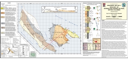
D.C. Katnick and P.S. Mustard
Geoscience Map 2001-03 presents geology of Denman and Hornby Islands off Central Vancouver Island in British Columbia.
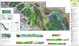
F. Ferri, S. Dudka, C. Rees, D. Meldrum and M. Willson
Geoscience Map 2001-04 presents the geology of Uslika Lake in North-central British Columbia.
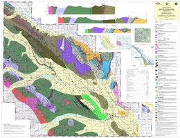
F. Ferri, S. Dudka, C. Rees, and D. Meldrum
Geoscience Map 2001-10 presents the geology of the Aiken Lake area of Northern British Columbia.
2000
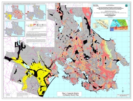
P.A. Monahan, and V.M. Levson, E.J. McQuarrie, S.M. Bean, P. Henderson, and A. Sy
The objective of this map is to show areas of Greater Victoria where the earthquake hazard is likely to be increased due to the presence of potentially unstable slopes, and soils susceptible to amplification of ground motion and/or liquefaction.
This map has been compiled from three other maps: a relative liquefaction hazard map, a relative amplification of ground motion hazard map, and an earthquake-induced slope instability hazard map.
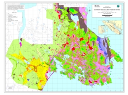
P.A. Monahan, and V.M. Levson
This map shows the thickness and distribution of the Quaternary stratigraphic units in Greater Victoria. It is intended to provide the geological basis for the assessment of the earthquake hazards shown on companion maps which depict the liquefaction and amplification of ground motion in Greater Victoria (Geoscience Maps 2000-3a and 2000-3b; Monahan et al., 2000b and c). The geological units shown here are defined in part to reflect these hazards.
Sheet 3A: Relative Liquefaction Hazard Map of Greater Victoria (Map and Accompanying Report); by P.A. Monahan, V.M. Levson, P. Henderson, and A. Sy
This map shows areas of Greater Victoria in which the earthquake hazard is potentially increased due to the presence of soils susceptible to liquefaction. Liquefaction is the transformation that occurs when earthquake shaking (or other disturbance) causes a saturated granular soil to lose its strength and behave like a liquid and can be one of the major causes of damage during an earthquake. The susceptibility of a site to liquefaction depends on the depth to water table and the density, grain size and age of the underlying deposits. This map was prepared by assigning a hazard rating to each geological map unit based on these criteria and quantitative analyses.
Sheet 3B: Relative Amplification of Ground Motion Hazard Map of Greater Victoria (Map and Accompanying Report); by P.A. Monahan, V.M. Levson, P. Henderson, and A. Sy
This map shows areas where the earthquake hazard is increased due to amplification of ground motion. The amplification of ground motion hazard has been estimated on the basis of the National Earthquake Hazard Reduction Program (NEHRP) site classes for the susceptibility to amplification of ground motion (Building Seismic Safety Council, 1994), which are based on the average response of various types of soils.
Sheet 3C: Seismic Slope Stability Map of Greater Victoria (Map); by E.J. McQuarrie, and S.M. Bean
Seismic slope hazard mapping is intended to show relative susceptibility to earthquake-induced slope failures. The seismic slope hazard map is based on a compilation of existing subsurface data, previous slope stability assessments, bedrock geology and surficial geology maps, topographic data, and airphoto interpretation. Stability analyses were conducted on twelve different slope models including typical or simplified slopes found throughout the Victoria area as well as specific, complex slope models where more detailed information was available. The stability analyses determined both the static factor of safety and the yield acceleration (the intensity of seismic motions that would cause a slope failure).
Superseded by Geoscience Map 2011-1
G.T. Nixon et al.
No Digital Map Available
Geoscience Map 2000-05 presents the geology of the San Josef and Quatsino map areas on northern Vancouver Island in British Columbia.
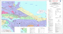
G.T. Nixon, J.L. Hammack, V.M. Koyanagi, G.J. Payie, J.W. Haggart, M.J. Orchard, T. Tozer, D.A. Archibald, R.M. Friedman, J. Palfy and F. Cordey
Geoscience Map 2000-06 is a final draft of the geology of the Port McNeill and Quatsino map areas on Northern Vancouver Island in British Columbia.
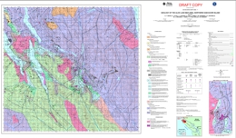
G.T. Nixon, G.J. Payie, L.D. Snyder, S. Long, A. Finnie, R.M . Friedman, D.A. Archibald, M.J. Orchard, T. Tozer, T.P. Poulton and J.W. Haggart
Geoscience Map 2000-07 presents a draft of the geology of the Alice Lake area of Northern Vancouver Island in British Columbia.
Superseded by Geoscience Map 2011-3
G.T. Nixon et al.
No Digital Map Available
Geoscience Map 2000-08 presents the geology of the Mahatta Creek area of Northern Vancouver Island in British Columbia.
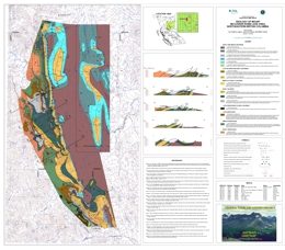
A. Legun, J. Nelson and M. Cecile
Geoscience Map 2000-09 presents the geology of the Mt. McCusker and Robb Lake areas in Northeastern British Columbia.
1998
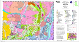
T. Höy and K.P.E. Dunne
Geoscience Map 1998-1 is a full colour compilation map, at 1:100 000 scale, of the Trail map area which extends south from Nelson to the United States border and west to Rossland and Castlegar. The area straddles the boundary between North American rocks and Quesnellia, including the southern part of the Kootenay arc.
There are many historical mining camps are in the Trail map area, including the carbonate-hosted lead-zinc deposits of the Salmo camp, silver-gold veins of the Ymir and Nelson camps, and the gold-copper veins of the Rossland camp. Accompanying the map is a table that classifies the more than 400 mineral deposits and occurrences in the map area.
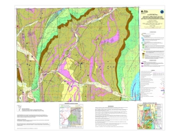
compilation by D.A. Brown
These three colour Geoscience Maps (1998-02, 1998-03, & 1998-04) cover areas in the Purcell anticlinorium. Exploration attention is focused in the Purcell anticlinorium, targeting favourable settings for new SEDEX deposits using the features found at the world class Sullivan Pb-Zn-Ag mine as indicators. The maps provide 1:50,000 scale geology with Sullivan-style indicators (e.g. sedimentary fragmentals, tourmalinite, albite alteration, garnet-rich zones) clearly shown and the locations of diamond drill holes.
Geoscience Map 1998-02 covers the core of the Moyie anticline and mineral occurrences in the Mt. Mahon-Yahk area. Map 1998-03 includes the extensively explored Fors-Vine areas and the newly discovered Panda Basin. Map 1998-04 covers the Findlay-Doctor Creek area, where recent drilling has identified stratiform sulphides in Upper Aldridge strata.
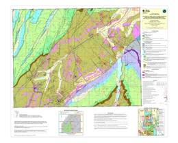
compilation by D.A. Brown
These three colour Geoscience Maps (1998-02, 1998-03, and 1998-04) cover areas in the Purcell anticlinorium. Exploration attention is focused in the Purcell anticlinorium, targeting favourable settings for new SEDEX deposits using the features found at the world class Sullivan Pb-Zn-Ag mine as indicators. The maps provide 1:50,000 scale geology with Sullivan-style indicators (e.g. sedimentary fragmentals, tourmalinite, albite alteration, garnet-rich zones) clearly shown and the locations of diamond drill holes.
Geoscience Map 1998-02 covers the core of the Moyie anticline and mineral occurrences in the Mt. Mahon-Yahk area. Map 1998-03 includes the extensively explored Fors-Vine areas and the newly discovered Panda Basin. Map 1998-04 covers the Findlay-Doctor Creek area, where recent drilling has identified stratiform sulphides in Upper Aldridge strata.
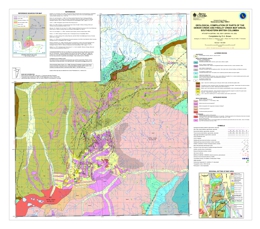
compilation by D.A. Brown
These three colour Geoscience Maps (1998-02, 1998-03, & 1998-04) cover areas in the Purcell anticlinorium. Exploration attention is focused in the Purcell anticlinorium, targeting favourable settings for new SEDEX deposits using the features found at the world class Sullivan Pb-Zn-Ag mine as indicators. The maps provide 1:50,000 scale geology with Sullivan-style indicators (e.g. sedimentary fragmentals, tourmalinite, albite alteration, garnet-rich zones) clearly shown and the locations of diamond drill holes.
Geoscience Map 1998-02 covers the core of the Moyie anticline and mineral occurrences in the Mt. Mahon-Yahk area. Map 1998-03 includes the extensively explored Fors-Vine areas and the newly discovered Panda Basin. Map 1998-04 covers the Findlay-Doctor Creek area, where recent drilling has identified stratiform sulphides in Upper Aldridge strata.
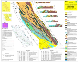
Superseded by Bulletin 107
F. Ferri, J. Nelson and C. Rees
These two maps (1998-09 and 1998-10), at 1:100,000 scale, display the geology and mineral occurrences of the western margin of the Kechika Trough between Gataga River and the 60th parallel.
The Kechika Trough is a Lower Paleozoic feature which connects northward to the Selwyn Basin. Together, these features represent an important metallotect within the northern Canadian Cordillera, hosting several large, world class sedex massive sulphide deposits (Cirque, Akie, Driftpile Creek, Howards Pass, Tom, Jason, Anvil).
In addition to the detailed geology of the northern Kechika Trough, these maps contain the locations and brief descriptions of numerous new mineral occurrences of sedex origin. The number and distribution of these occurrences, together with similar showings to the south, reinforces the importance of the Kechika Trough as a sedex province and indicates its potential to host other large deposits.
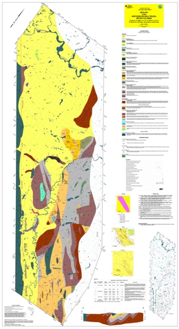
Superseded by Bulletin 107
F. Ferri, C. Rees, J. Nelson, A. Legun
These two maps (1998-09 and 1998-10), at 1:100,000 scale, display the geology and mineral occurrences of the western margin of the Kechika Trough between Gataga River and the 60th parallel.
The Kechika Trough is a Lower Paleozoic feature which connects northward to the Selwyn Basin. Together, these features represent an important metallotect within the northern Canadian Cordillera, hosting several large, world class sedex massive sulphide deposits (Cirque, Akie, Driftpile Creek, Howards Pass, Tom, Jason, Anvil).
In addition to the detailed geology of the northern Kechika Trough, these maps contain the locations and brief descriptions of numerous new mineral occurrences of sedex origin. The number and distribution of these occurrences, together with similar showings to the south, reinforces the importance of the Kechika Trough as a sedex province and indicates its potential to host other large deposits.
1997
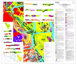
Superseded by Bulletin 105
compiled by M.G. Mihalynuk; geology by M.G. Mihalynuk, K.J. Mountjoy, L.D. Currie, M.T. Smith and J.N. Rouse
The Tagish Lake area has been recognized as an important mineral belt since 1896, when hoardes of placer miners bound for the Klondike passed through it. It continues to be a focus for mineral exploration, but today these are guided by a respect for the geological diversity and complexity of the area. Geoscience Map 1997-01 encompasses critical components of the terrane architecture in the northern Intermontane Belt. From east to west these include: oceanic crustal rocks of the Cache Creek Terrane, overlap strata of the Whitehorse Trough, volcanic arc strata and metamorphic basement of Stikine Terrane, metamorphosed continental margin rocks of the Nisling Terrane and volcano-plutonic complexes adjacent to the Coast belt.
Two crustal scale faults, the Llewellyn and Nahlin, are focal points because they juxtapose terranes and are loci of gold mineralization, including the Engineer and Venus Mines. Map 1997-1 illustrates the relationships between mineral occurrences and tectonic features in an area of high mineral potential extending from south of Tagish Lake to the BC-Yukon border.
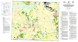
L.J. Diakow and V.M. Levson
This colored geological map (1:100,000 scale) is a compilation of bedrock and surficial geology data from the area between the Nechako Reservoir and the Blackwater River. The inferred extent of mineralizing plutons and prospective rhyolites are also shown, as are fossil and age dating sites, ice flow direction indicators, geochemical sample sites, and the distribution and nature of surficial sediments that are most usable for local geochemical surveys.
Widespread drift cover, and lack of geological and geochemical information has hindered exploration in this region in the past. In 1993 and 1994 the members of the Interior Plateau Project discovered several new precious metal occurrences and identified geochemical anomalies that are significant new targets for mineral exploration. The region has significant untested mineral potential and is undergoing active mineral exploration, mainly for precious metal deposits.
The geology of the map area is discussed in detail in the Interior Plateau Project volume (BCGS Paper 1997-02 and GSC Open File 3448) which summarizes results from a variety of geological studies conducted in the vast Interior Plateau region west of the Fraser River and east of the Coast Mountains in central British Columbia. The Interior Plateau Project was conducted under the auspices of the Federal-Provincial Mineral Development Agreement (1991-1995).
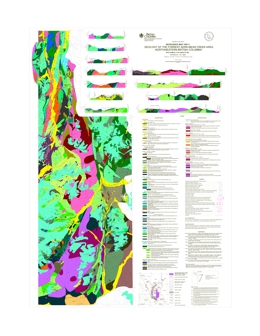
J.M. Logan, J.R. Drobe, V.M. Koyanagi and D.C. Elsby
This coloured geological map (1:100,000 scale) is a compilation of the bedrock geology along the Forrest Kerr and Mess creeks, a 3 000 square kilometre area situated between Iskut River and Mess Lake. This part of Stikinia is composed of rocks spanning at least 400 Ma: from Early Devonian volcanic arc deposits to the hotspring tufa deposits forming today in Mess Creek valley. Eleven vertical cross sections are shown, as are the locations of mineral occurrences, fossils and age dating sites.
Mapping was carried out between 1989 and 1993. The map provides a tectonic framework for a variety of mineral deposits: the Au and Ag-enriched calcalkaline Schaft Creek copper-molybdenum porphyry deposit, the McLymont Au skarn, the Bam copper-silver replacement and other exploration properties including the Foremore, Forrest, Goz/RDN and Forgold. Age dating and fossil collections have established time constraints on the formation of some of these mineral occurrences. The work identified several highly prospective stratigraphic intervals and documented plutonic suites which are significant new targets for mineral exploration.
1995
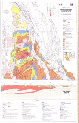
T. Höy, R.A. Price, A. Legun, B. Grant and D. Brown
Geoscience Map 1995-01 is a geological compilation map of the Purcell Supergroup in southeastern British Columbia.
GIS files for download, including Manifold MAP, ESRI Shape and KML files, are available in GeoFile 2007-02, Belt-Purcell Metallogenic Data and Map by D.G. MacIntyre.
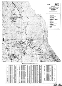
D. Jakobsen and T. Höy
Geoscience Map 1995-02 presents mineral occurrences in the Purcell Supergroup in southeastern British Columbia.
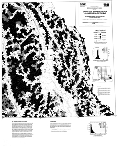
W. Jackaman, S.J. Sibbick and P.F. Matysek
Geoscience Map 1995-03 presents the geochemistry of the Purcell Supergroup in southeastern British Columbia.
1994
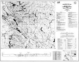
F. Ferri and D.M. Melville
Geoscience Map 1994-1 presents the geology of the Manson Creek map-area (93N/9) in east-central British Columbia. The 1:50,000 scale geological map includes a legend, geological cross section, references, and a table of mineral occurrences.
The area is cut by a series of major northwest trending faults that juxtapose disparate crustal levels. The oldest package exposed, the Upper Proterozoic Ingenika Group contains five formations. The Swannell Formation has four units: quartz-feldspathic paragneiss, amphibolite gneiss, calcsilicate gneiss, and marble cut by abundant granite and granite pegmatite bodies; mainly quartzofeldspathic paragneiss and schist, also cut by abundant granite and granite pegmatite bodies; quartz-feldspathic paragneiss, quartz-feldspar mica schist, micaceous metaquartzite, and calcsilicate and amphibolite gneiss; and micaceous metaquartzite, quartz-mica schist and metaquarztite. The Tsaydiz Formation consists mainly of slate, phyllite, and thinly bedded limestone to argillaceous limestone. The Espee Formation is dominantly limestone; and the Stelkuz Formation is slate, siltstone, sandstone and impure quartzite. The Paleozoic (?) and Proterozoic Boulder Creek Group consist of phyllite, slate, siltstone, schist, sandstone, and limestone or marble. The Upper (?) Devonian to Permian Big Creek Group has a lower unit dominated by shale and argillite, and an upper unit that is mainly argillite. Mississippian to Permian rocks include the Manson Lakes Ultramafics, which are mainly serpentinite with local schistose zones containing talc or mariposite, and the Mount Howell Succession of the Nina Creek Group. The Mount Howell Succession has sill-like gabbro bodies, and an argillite, siliceous argillite, chert, basalt, wackes, limestone and tuff unit. The Pillow Ridge Succession of the Nina Creek Group is of Pennsylvanian to Permian age. It consists of massive and pillowed basalt, chert, siliceous argillite and gabbro. Middle to Upper Triassic strata of the Nicola Group in the area include the Slate Creek and Plughat Mountain successions. The Slate Creek contains a unit dominated by massive and pillowed basalt, and a unit with argillite, slate, calcareous argillite, and siliceous argillite. The Plughat Mountain Succession consists mainly of tuff and agglomerate with a small epiclastic component.
The oldest intrusive rocks in the area are Devonian to Mississippian carbonatites, mainly biotite sovite, as well as foliated syenite and monzonite. The Upper Paleozoic or younger Wolf Ridge gabbro is also foliated. The Cretaceous Germansen batholith consists mainly of biotite-muscovite granite to granodiorite. It is megacrystic and has associated garnet-bearing pegmatites and aplite dikes. The Cretaceous or younger Wolverine Range intrusions comprise garnet-muscovite-biotite granodiorite to granite and related pegmatite. Tertiary intrusions are subvolcanic feldspar phyric andesite associated with monzonite to quartz monzonite dikes and irregular bodies.
The metamorphic rocks of the Wolverine metamorphic complex record several periods of deformation. Paleozoic and Triassic strata tend to be steeply inclined or within upright folds. Major northwest to northerly trending faults dominate the structural fabric of the area. Movement has been both strike slip and vertical.
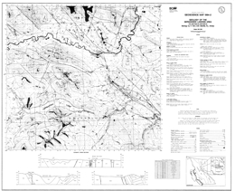
F. Ferri, D.M. Melville and R.L. Arksey
Geoscience Map 1994-02 presents the geology of the Germansen Landing Area (93N/10, 15) in east-central British Columbia.
The 1:50,000 scale geological map includes a legend, geological cross section, references, and a table of mineral occurrences.
The area is cut by a series of major northwest trending faults that juxtapose disparate crustal levels. The oldest package exposed, the Upper Proterozoic Ingenika Group contains five formations. The Swannell Formation has four units: quartz-feldspathic paragneiss, amphibolite gneiss, calcsilicate gneiss, and marble cut by abundant granite and granite pegmatite bodies; mainly quartzofeldspathic paragneiss and schist, also cut by abundant granite and granite pegmatite bodies; quartz-feldspathic paragneiss, quartz-feldspar mica schist, micaceous metaquartzite, and calcsilicate and amphibolite gneiss; and micaceous metaquartzite, quartz-mica schist and metaquarztite. The Tsaydiz Formation consists mainly of slate, phyllite, and thinly bedded limestone to argillaceous limestone. The Espee Formation is dominantly limestone; and the Stelkuz Formation is slate, siltstone, sandstone and impure quartzite. The Paleozoic (?) and Proterozoic Boulder Creek Group consist of phyllite, slate, siltstone, schist, sandstone, and limestone or marble. The Upper (?) Devonian to Permian Big Creek Group has a lower unit dominated by shale and argillite, and an upper unit that is mainly argillite. Mississippian to Permian rocks include the Manson Lakes Ultramafics, which are mainly serpentinite with local schistose zones containing talc or mariposite, and the Mount Howell Succession of the Nina Creek Group. The Mount Howell Succession has sill-like gabbro bodies, and an argillite, siliceous argillite, chert, basalt, wackes, limestone and tuff unit. The Pillow Ridge Succession of the Nina Creek Group is of Pennsylvanian to Permian age. It consists of massive and pillowed basalt, chert, siliceous argillite and gabbro. Middle to Upper Triassic strata of the Nicola Group in the area include the Slate Creek and Plughat Mountain successions. The Slate Creek contains a unit dominated by massive and pillowed basalt, and a unit with argillite, slate, calcareous argillite, and siliceous argillite. The Plughat Mountain Succession consists mainly of tuff and agglomerate with a small epiclastic component.
The oldest intrusive rocks in the area are Devonian to Mississippian carbonatites, mainly biotite sovite, as well as foliated syenite and monzonite. The Upper Paleozoic or younger Wolf Ridge gabbro is also foliated. The Cretaceous Germansen batholith consists mainly of biotite-muscovite granite to granodiorite. It is megacrystic and has associated garnet-bearing pegmatites and aplite dikes. The Cretaceous or younger Wolverine Range intrusions comprise garnet-muscovite-biotite granodiorite to granite and related pegmatite. Tertiary intrusions are subvolcanic feldspar phyric andesite associated with monzonite to quartz monzonite dikes and irregular bodies.
The metamorphic rocks of the Wolverine metamorphic complex record several periods of deformation. Paleozoic and Triassic strata tend to be steeply inclined or within upright folds. Major northwest to northerly trending faults dominate the structural fabric of the area. Movement has been both strike slip and vertical.
Mineral occurrences in the area include niobium, zirconium, titanium, uranium, thorium, and rare earth elements in the carbonatites, polymetallic silver-lead-zinc with or without gold deposits, gold quartz vein deposits, rare element pegmatites, and porphyry copper-molybdenum deposits associated with the Germansen batholith.
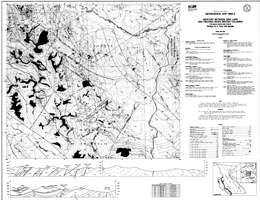
F. Ferri and D.M. Melville (93N/15; 94C/2)
Geoscience Map 1994-03 presents the geology between the Nina Lake and Oslinka River areas in British Columbia.
1993
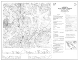
J.M. Logan, V.M. Koyanagi and D. Rhys
Geoscience Map 1993-01 presents the geology and mineral occurrences of the Galore Creek area (104G/03). The 1:50,000 scale geological map includes a legend, four geological cross sections, and a reference list.
Stikine assemblage strata range in age from Devonian to Permian. Devonian to Lower Carboniferous strata include units dominated by quartz sericite schist; limestone; and mafic and felsic flows, and intermediate crystal tuff, breccia and flows. Lower Carboniferous rocks include grainstone with chert interbeds and packstone with tuff and epiclastic interbeds. Upper Carboniferous to Lower Permian units are mainly conglomerate, siliceous siltstone and felsic dust tuff, and volcaniclastic rocks. Lower Permian strata include bioclastic grainstone, epiclastics and tuff.
Lower Triassic siliceous and limy siltstones are overlain by carbonaceous silty shale of Middle Triassic age. Upper Triassic Stuhini Group units include silicic clastics and volcanic wackes; siltstone, sandstone and augite crystal tuffs and flows; plagioclase and basaltic –andesite and hornblende porphyry flows and tuffs; intermediate breccia flows, lahar and fragmentals; fine black clastics, tuff and conglomerate; and pyroxene porphyry breccia flows.
Upper Triassic to Lower Jurassic strata comprise a volcanic facies, with potassium-feldspar and pseudoleucite-bearing fragmentals and alkaline basalt flows, and a sedimentary facies with potassium-feldspar crystal tuff, epiclastics and volcanic conglomerate. Lower Jurassic strata include a unit of polymictic volcanic conglomerate, siltstone, shale and airfall tuff, and a unit of mainly felsic tuffite.
The oldest intrusive rocks are Late Devonian hornblende diorites. Middle to Late Triassic intrusions include ultramafic rocks, with gabbro and pyroxenite bodies, and granodiorite to monzonite of the Hickman batholith. The Late Triassic to Early Jurassic Galore Creek intrusions consist of syenite, and porphyritic monzonite. Early Jurassic intrusions are quartz diorite and granodiorite, and porphyritic diorite may be Early Jurassic or younger. Eocene intrusions are granodiorite, and potassium feldspar-megacrystic granite and equigranular quartz monzonite.
Structural style at Galore Creek is dominated by brittle deformation and faulting and controlled by competency contrasts between volcanic and sedimentary rocks of the arc assemblage. Three or possibly four episodes of deformation have been recognized, but ages are poorly constrained. The earliest structures are synmetamorphic, and pre-Triassic, possibly Carboniferous, age. These structures, and related northeast-striking penetrative foliations, are deformed by west-trending post-Triassic (?) folds. Two post-Early Jurassic events are recognized, one is characterized by north-trending southwest-verging folds and reverse faults; and the younger is characterized by northeast-verging kink folds.
Metallogeny in the Galore area is related to plate boundary subduction processes and two separate mineralizing events, one in the latest Late Triassic and one in the Eocene. Each is characterized by a different base and precious metal suite. A Late Triassic to Early Jurassic alkalic volcanic centre at Galore Creek hosts ten synvolcanic copper-gold deposits. The largest, the Stikine Copper Limited central zone contains 125 000 000 tonnes of material with an estimated grade of 1.06 per cent copper, 0.4 gram per tonne gold and 7.7 grams per tonne silver. A similar deposit occurs at Copper Canyon.
Pervasive potash metasomatism and retrograde calcsilicate alteration characterize the mineralized zones. Smaller tonnage, Eocene silver-rich base metal veins are associated with calcalkaline intrusions and hosted in northeasterly-striking faults at the Trek property and breccia-pipes at the Ptarmigan zone. Alteration and gangue minerals are quartz, sericite, and iron carbonate assemblages. Volcanogenic massive sulphide deposits (e.g., Tulsequah Chief) are an untested but viable exploration target in the Paleozoic Stikine assemblage rocks.
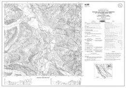
J.M. Logan, V.M. Koyanagi and D. Rhys
Geoscience Map 1993-02 presents the geology and mineral occurrences of the Galore Creek area (104G/04). The 1:50,000 scale geological map includes a legend, four geological cross sections, and a reference list.
Stikine assemblage strata range in age from Upper Carboniferous to Lower Permian. Upper Carboniferous to Lower Permian strata include units dominated by siliceous siltstones and felsic dust tuffs. Lower Permian strata are mainly bioclastic grainstone, epiclastics and tuff overlying bioclastic limestone with chert interbeds.
Upper Triassic Stuhini Group units include silicic clastics and volcanic wackes; siltstone, sandstone and augite crystal tuffs and flows; plagioclase and basaltic–andesite and hornblende porphyry flows and tuffs; intermediate breccia flows, lahar and fragmentals; fine black clastics, tuff and conglomerate; and pyroxene porphyry breccia flows.
Upper Triassic to Lower Jurassic strata comprise a volcanic facies, with potassium-feldspar and pseudoleucite-bearing fragmentals and alkaline basalt flows, and a sedimentary facies with potassium-feldspar crystal tuff, epiclastics and volcanic conglomerate.
The oldest intrusive rocks are Middle to Late Triassic intrusions of the Hickman batholith that range from granodiorite to monzonite and plagioclase megacrystic diorite. The Late Triassic to Early Jurassic Galore Creek intrusions consist of syenite, and porphyritic monzonite. Early Jurassic intrusions are quartz diorite to granodiorite, and potassium feldspar megacrystic granite to quartz monzonite. Eocene intrusions are granodiorite, and potassium feldspar-megacrystic granite and equigranular quartz monzonite.
Structural style at Galore Creek is dominated by brittle deformation and faulting and controlled by competency contrasts between volcanic and sedimentary rocks of the arc assemblage. Three or possibly four episodes of deformation have been recognized, but ages are poorly constrained. The earliest structures are synmetamorphic, and pre-Triassic, possibly Carboniferous, age. These structures, and related northeast-striking penetrative foliations, are deformed by west-trending post-Triassic (?) folds. Two post-Early Jurassic events are recognized, one is characterized by north-trending southwest-verging folds and reverse faults; and the younger is characterized by northeast-verging kink folds.
Metallogeny in the Galore area is related to plate boundary subduction processes and two separate mineralizing events, one in the latest Late Triassic and one in the Eocene. Each is characterized by a different base and precious metal suite. A Late Triassic to Early Jurassic alkalic volcanic centre at Galore Creek hosts ten synvolcanic copper-gold deposits. The largest, the Stikine Copper Limited central zone contains 125 000 000 tonnes of material with an estimated grade of 1.06 per cent copper, 0.4 gram per tonne gold and 7.7 grams per tonne silver. A similar deposit occurs at Copper Canyon. Pervasive potash metasomatism and retrograde calcsilicate alteration characterize the mineralized zones. Smaller tonnage, Eocene silver-rich base metal veins are associated with calcalkaline intrusions and hosted in northeasterly-striking faults at the Trek property and breccia pipes at the Ptarmigan zone. Alteration and gangue minerals are quartz, sericite, and iron carbonate assemblages. Volcanogenic massive sulphide deposits (e.g., Tulsequah Chief) are an untested but viable exploration target in the Paleozoic Stikine assemblage rocks.
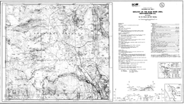
D. Brown and M.H. Gunning
Geoscience Map 1993-03 presents the geology and mineral occurrences of the Scud River area (104G/05) in northwestern British Columbia. The 1:50,000 scale geological map includes a legend, geological cross sections, and a reference source inset map.
Stikine assemblage strata range in age from Upper Carboniferous to Lower Permian. Upper Carboniferous strata include a unit with foliated, pyroxene-feldspar phyric andesitic flows and sills, crystal tuff, lithic lapilli tuff and recrystallized limestone; and a unit with foliated argillite, siltstone, calcareous siltstone, conglomerate and recrystallized limestone. A possibly Upper Carboniferous unit consists of massive to foliated siltstone, conglomerate, andesite, and tuff. Upper Carboniferous to Lower Permian strata are mainly bedded to laminated sericitic ash tuff and tuffaceous siltstone, chert, and calcareous siltstone. Lower to Upper Permian strata include a unit that is mainly pyrite and pyrrhotite-bearing argillite and siltstone, and a calcarenite unit with minor chert layers and nodules.
Upper Triassic and possibly older metamorphic rocks may be Stuhini Group equivalents. They consist of massive to foliated metavolcanics, biotite schist, chert, chlorite schist and siliceous rock. Volcanic rocks represent the Upper Triassic Stuhini Group.
The Late Triassic to Early Jurassic Copper Mountain Suite intrusions are the oldest intrusive rocks in the area. They consist of megacrystic quartz monzonite, equigranular to megacrystic syenite, and clinopyroxenite. Early Jurassic (?) quartz diorite, hornblende diorite, hornblendite and pyroxenite comprise the Diorite Suite. The Late Early Jurassic Cone Mountain Suite intrusions are granodiorite and quartz monzodiorite. The Middle Jurassic Three Sisters Suite contains mainly hornblende biotite granite. The Eocene Hyder Suite of intrusions includes biotite granite that is locally potassium feldspar-megacrystic, hornblende-biotite granodiorite, megacrystic granodiorite, and felsite. Tertiary and older dikes are andesite, basalt, felsite, olivine basalt, rhyolite and syenite.
Structural style in the area is dominated by brittle deformation and faulting and controlled by competency contrasts between volcanic and sedimentary rocks. Three or possibly four episodes of deformation have been recognized, but ages are poorly constrained. The earliest structures are synmetamorphic, and pre-Triassic, possibly Carboniferous, age. These structures, and related northeast-striking penetrative foliations, are deformed by west-trending post-Triassic (?) folds. Northerly-trending southwest-verging folds and contractional faults are post-Early Jurassic.
Metallogeny in the area is related to plate boundary subduction processes and two separate mineralizing events, one in the latest Late Triassic and one in the Eocene. Each is characterized by a different base and precious metal suite. A Late Triassic to Early Jurassic alkalic volcanic centre at Galore Creek, to the south, hosts ten synvolcanic copper-gold deposits.
The largest, the Stikine Copper Limited central zone contains 125 000 000 tonnes of material with an estimated grade of 1.06per cent copper, 0.4 gram per tonne gold and 7.7 grams per tonne silver. A similar deposit occurs at Copper Canyon. Pervasive potash metasomatism and retrograde calcsilicate alteration characterize the mineralized zones. Smaller tonnage, Eocene silver-rich base metal veins are associated with calcalkaline intrusions and hosted in northeasterly-striking faults. Alteration and gangue minerals are quartz, sericite, and iron carbonate assemblages. Volcanogenic massive sulphide deposits (e.g., Tulsequah Chief) are an untested but viable exploration target in the Paleozoic Stikine assemblage rocks.
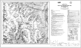
D. Brown and M.H. Gunning
Geoscience Map 1993-04 presents the geology and mineral occurrences of the Scud Glacier area (104G/06) in northwestern British Columbia. The 1:50,000 scale geological map includes a legend, geological cross sections, references, and a reference source inset map.
Stikine assemblage strata range in age from Upper Carboniferous to Lower Permian. Upper Carboniferous strata include a unit with foliated, pyroxene-feldspar phyric andesitic flows and sills, crystal tuff, lithic lapilli tuff and recrystallized limestone; and a unit with foliated argillite, siltstone, calcareous siltstone, conglomerate and recrystallized limestone. A Paleozoic or Upper Triassic unit consists of massive to foliated siltstone, conglomerate, andesite, and tuff. Upper Carboniferous to Lower Permian strata are mainly bedded to laminated sericitic ash tuff and tuffaceous siltstone, chert, and calcareous siltstone. Lower to Upper Permian strata include a unit that is mainly pyrite and pyrrhotite-bearing argillite and siltstone, calcarenite unit with minor chert layers and nodules, and a maroon tuffaceous limestone unit.
Upper Triassic and possibly older metamorphic rocks may be Stuhini Group equivalents. They consist of massive to foliated metavolcanics, biotite schist, chert, chlorite schist and siliceous rock. Stuhini Group strata consist of a lower unit dominated by volcanic rocks that contains pyroxene-phyric flows and breccias, epiclastics, limestone, phyllite and conglomerate; and an upper unit with mainly sedimentary rocks including sandstone, siltstone, argillite and limestone lenses. Lower to Middle Jurassic Hazelton Group is represented by polymictic conglomerate.
Middle to Late Triassic olivine clinopyroxenite, dunite and gabbro comprise the oldest intrusive rocks in the area. The Middle to Late Triassic Stikine Suite intrusions consist of gabbro and hornblendite, quartz monzonite, biotite granodiorite, monzodiorite, quartz diorite, diorite and plagioclase megacrystic quartz diorite. The Late Early Jurassic Cone Mountain Suite intrusions are granodiorite and quartz monzodiorite. The Middle Jurassic Three Sisters Suite contains mainly hornblende biotite granite. The Eocene Hyder Suite of intrusions includes biotite granite that is locally potassium feldspar-megacrystic, hornblende-biotite granodiorite, megacrystic granodiorite, and felsite. Chlorite-altered plagioclase phyric granodiorite is Tertiary (or Early Jurassic). Tertiary and older dikes are andesite, basalt, felsite, olivine basalt, rhyolite and syenite.
Structural style in the area is dominated by brittle deformation and faulting and controlled by competency contrasts between volcanic and sedimentary rocks. Three or possibly four episodes of deformation have been recognized, but ages are poorly constrained. The earliest structures are synmetamorphic, and pre-Triassic, possibly Carboniferous, age.
These structures, and related northeast-striking penetrative foliations, are deformed by west-trending post-Triassic (?) folds. Northerly-trending southwest-verging folds and contractional faults are post-Early Jurassic, and extensional faults are at least in part of Tertiary age.
Metallogeny in the area is related to plate boundary subduction processes and two separate mineralizing events, one in the latest Late Triassic and one in the Eocene. Each is characterized by a different base and precious metal suite. A Late Triassic to Early Jurassic alkalic volcanic centre at Galore Creek, to the south, hosts ten synvolcanic copper-gold deposits.
The largest, the Stikine Copper Limited central zone contains 125 000 000 tonnes of material with an estimated grade of 1.06per cent copper, 0.4 gram per tonne gold and 7.7 grams per tonne silver. A similar deposit occurs at Copper Canyon. Pervasive potash metasomatism and retrograde calcsilicate alteration characterize the mineralized zones. The large calcalkaline Schaft Creek copper deposit is located in the adjacent map area to the east. Reserves at Schaft Creek are 900 million tonnes at 0.30 per cent copper and values in gold and silver. Smaller tonnage, Eocene silver-rich base metal veins are associated with calcalkaline intrusions and hosted in northeasterly-striking faults. Alteration and gangue minerals are quartz, sericite, and iron carbonate assemblages. Volcanogenic massive sulphide deposits (e.g., Tulsequah Chief) are an untested but viable exploration target in the Paleozoic Stikine assemblage rocks.
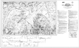
D. Brown, C.J. Greig and M.H. Gunning
Geoscience Map 1993-05 presents the geology and mineral occurrences of the Yehinko Lake and Chutine River area (104G/11W, 12) in northwestern British Columbia. The 1:50,000 scale geological map includes a legend, geological cross sections, and a reference source inset map.
Permian or older rocks comprise a package of foliated volcanic sand sedimentary rocks, including pillow basalt and recrystallized limestone. Stikine assemblage strata range in age from Lower to Upper Permian. Upper Carboniferous strata include a unit with foliated, pyroxene-feldspar phyric andesitic flows and sills, crystal tuff, and lithic lapilli tuff; and a unit with foliated argillite, siltstone, calcareous siltstone, and conglomerate. Lower to Upper Permian strata are mainly calcarenite with minor chert layers and nodules. Early Permian to perhaps Middle Triassic strata consist of chert, ribbon chert, siliceous siltstone, tuff and mudstone.
Upper Triassic Stuhini Group strata consist of a lower unit dominated by volcanic rocks and an upper unit dominated by sediments. The lower unit contains mafic volcanic rocks, including pyroxene-phyric flows and breccias; intermediate volcanic rocks including tuff, epiclastics, and conglomerate; plagioclase-rich tuffaceous wacke; and bladed plagioclase-phyric basalt or andesite flows; and undifferentiated volcanic rocks. The upper unit contains mainly sedimentary rocks including tuffaceous siltstone and wacke; and sandstone, siltstone, argillite and limestone lenses. Above the sedimentary unit are undifferentiated volcanic and sedimentary rocks. Lower to Middle Jurassic Hazelton Group is represented by a rhyolite flow unit; limy sandstone, feldspathic wacke and arenite with limestone lenses; dacite to basaltic andesite flows, tuff-breccia and tuff; rhyodacite/dacite ignimbrite flows; olivine basalt flows; and undifferentiated volcanic rocks. The Upper Cretaceous (?) to Paleocene Brothers Peak Formation of the Sustut Group consists of polymictic conglomerate, and lesser sandstone; rhyolite ash to lapilli tuff; and rhyolite to rhyodacite flows. The Eocene Sloko Group has trachyandesite and basalt flows; and locally welded dacite to rhyolite, and tuff-breccia and tuff.
Middle to Late Triassic Alaskan-type ultramafic rocks include olivine clinopyroxenite and dunite that comprise the oldest intrusive rocks in the area. The Middle to Late Triassic Stikine Suite intrusions consist of quartz monzonite, hornblende-biotite granodiorite, monzodiorite, quartz diorite, diorite and potassium feldspar megacrystic tonalite. The Late Early Jurassic Texas Creek Suite intrusions are monzodiorite and quartz monzonite. The late Early Jurassic Cone Mountain Suite has granodiorite and monzodiorite intrusions. The Middle Jurassic Three Sisters Suite contains porphyritic monzonite to monzodiorite; hornblende granite to quartz monzonite stocks with associated dikes; and hornblende biotite granite. The Eocene Hyder Suite of intrusions includes biotite granite that is locally potassium feldspar-megacrystic, hornblende-biotite granodiorite, and felsite. Tertiary and older dikes are andesite, basalt, felsite, olivine basalt, rhyolite and syenite.
Structural style in the area is dominated by brittle deformation and faulting and controlled by competency contrasts between volcanic and sedimentary rocks. Three or possibly four episodes of deformation have been recognized, but ages are poorly constrained. The earliest structures are synmetamorphic, and pre-Triassic, possibly Carboniferous, age.
These structures, and related northeast-striking penetrative foliations, are deformed by west-trending post-Triassic (?) folds. Northeast-directed northwest trending reverse faults in the southeast half of the map-sheet and northeasterly trending northeast-directed folds and contractional faults in the northwest half of the mapsheet are post-Early Jurassic.
Metallogeny in the area is related to plate boundary subduction processes and two separate mineralizing events, one in the latest Late Triassic and one in the Eocene. Each is characterized by a different base and precious metal suite. A Late Triassic to Early Jurassic alkalic volcanic centre at Galore Creek, to the south, hosts ten synvolcanic copper-gold deposits.
The largest, the Stikine Copper Limited central zone contains 125 000 000 tonnes of material with an estimated grade of 1.06per cent copper, 0.4 gram per tonne gold and 7.7 grams per tonne silver. A similar deposit occurs at Copper Canyon. Pervasive potash metasomatism and retrograde calcsilicate alteration characterize the mineralized zones. Smaller tonnage, Eocene silver-rich base metal veins are associated with calcalkaline intrusions and hosted in northeasterly-striking faults. Alteration and gangue minerals are quartz, sericite, and iron carbonate assemblages. Volcanogenic massive sulphide deposits (e.g., Tulsequah Chief) are an untested but viable exploration target in the Paleozoic Stikine assemblage rocks.
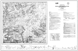
D. Brown
Geoscience Map 1993-06 presents the geology and mineral occurrences of the Tahltan Lake area (104G/13) in northwestern British Columbia. The 1:50,000 scale geological map includes a legend, geological cross sections, and a reference source inset map.
Stikine assemblage strata are of Paleozoic age. Permian or older rocks comprise a package of foliated volcanic sand sedimentary rocks, including recrystallized limestone. Upper Carboniferous strata include a unit with foliated, pyroxene-feldspar phyric andesitic flows and sills, crystal tuff, and lithic lapilli tuff, and massive andesite; and a unit with foliated argillite, siltstone, calcareous siltstone, and conglomerate. Upper Carboniferous to Lower Permian strata are mainly sericitic ash tuff and tuffaceous siltstone, chert, and calcareous siltstone. Lower Permian strata are mainly calcarenite with minor chert layers and nodules. Early Permian to perhaps Middle Triassic strata consist of chert, ribbon chert, siliceous siltstone, tuff and mudstone.
Amphibolite bodies in the area are of uncertain age. Middle to Late Triassic intrusions consist of diorite to granodiorite. The Late Triassic to Early Jurassic Copper Mountain Suite of intrusions includes syenite with local potassic feldspar megacrysts, quartz monzonite, and magnetite-biotite clinopyroxenite bodies. The Early Jurassic Texas Creek Suite has monzodiorite and quartz monzonite intrusions. Tertiary and older dikes are andesite, basalt, felsite, olivine basalt, rhyolite and syenite.
Structural style in the area is dominated by brittle deformation and faulting and controlled by competency contrasts between volcanic and sedimentary rocks. Three or possibly four episodes of deformation have been recognized, but ages are poorly constrained. The earliest structures are synmetamorphic, and pre-Triassic, possibly Carboniferous, age. These structures, and related northeast-striking penetrative foliations, are deformed by west-trending post-Triassic (?) folds. Several structural culminations are cored by rocks of the Stikine assemblage and bounded by northeast-striking high angle reverse faults.
Metallogeny in the area is related to plate boundary subduction processes and two separate mineralizing events, one in the latest Late Triassic and one in the Eocene. Each is characterized by a different base and precious metal suite. A Late Triassic to Early Jurassic alkalic volcanic centre at Galore Creek, to the south, hosts ten synvolcanic copper-gold deposits. The largest, the Stikine Copper Limited central zone contains 125 000 000 tonnes of material with an estimated grade of 1.06 per cent copper, 0.4 gram per tonne gold and 7.7 grams per tonne silver. A similar deposit occurs at Copper Canyon. Pervasive potash metasomatism and retrograde calcsilicate alteration characterize the mineralized zones. To the north, carbonate-hosted disseminated Au-Ag characterizes the former Golden Bear mine, and there is potential for epithermal Au-Ag: low sulphidation mineralization. Smaller tonnage, Eocene silver-rich base metal veins are associated with calcalkaline intrusions and hosted in northeasterly-striking faults. Alteration and gangue minerals are quartz, sericite, and iron carbonate assemblages. Volcanogenic massive sulphide deposits (e.g., Tulsequah Chief) are an untested but viable exploration target in the Paleozoic Stikine assemblage rocks.
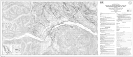
P. Schiarizza and R.G. Gaba
Geoscience Map 1993-07 presents the geology of the Bralorne (North half) and Northeastern Dickson Range Map Areas (92J/14, 15). The publication consists of a 1:50,000 scale geology map with legend and reference list.
The area is underlain by Ophiolitic assemblages, strata of the Cadwallader, Bridge River and Relay Mountain terranes, and overlap assemblages. The Ophiolitic assemblages include an assemblage of serpentinite, serpentinized ultramafite, and listwanite altered rocks; the Permian and younger Shulaps Ultramafic Complex with a harzburgite unit and a serpentinite melange unit; and the Bralorne-East Liza Complex of pillowed and massive greenstones, diabase, gabbro, diorite, soda granite, serpentinite and minor limestone and chert. Cadwallader Terrane strata include the Upper Triassic Cadwallader and Tyaughton Groups, the Lower to Middle Jurassic Last Creek Formation, and the Jurassic (?) Downton Lake unit. The Cadwallader Group is represented by the Hurley Formation, which consists of a volcanic greenstone-tuff unit, a unit with similar rocks intercalated with sandstone, tuffaceous sandstone, limestone and conglomerate, and a unit comprised mainly of sandstone, calcarenite and siltstone. Tyaughton Group strata are dominated by conglomerate and conglomeratic sandstone intercalated with sandstone. The Last Creek Formation contains sandstone, siltstone and conglomerate, and black shale layers. The Downton Lake unit comprises mainly siliceous argillite and siltstone. Bridge River Terrane components include the Bridge River Complex and the Cayoosh Assemblage. The Bridge River Complex consists of Mississippian to Middle Jurassic strata consisting of pelitic and calcareous schist, metachert and marble; serpentinite with knockers of other Bridge River rocks; and ribbons chert, argillite, phyllite, greenstone and lesser limestone, gabbro, diabase, sandstone, conglomerate and serpentinite; Triassic and perhaps older blueschists include non-schistose greenstones with minor amounts of blue amphiboles; Upper Triassic mainly pillowed to massive greenstones and Lower Norian limestone; and Jurassic and perhaps older argillite, sandstone and chert. The Cayoosh Assemblage is of Jurassic and/or Cretaceous age. It contains the Gun Lake clastic unit, of mainly sandstone, siltstone and shale; and the Traux Creek polymict conglomerate. The Relay Mountain-Bridge River overlap assemblage consists of the Lower and perhaps Upper Cretaceous Taylor Creek Group and the Upper Cretaceous Powell Creek Formation. The Taylor Creek Group has a lower volcanic sandstone, conglomerate and shale unit; the Dash Formation of mainly chert pebble conglomerate, chert-rich sandstone, shale and siltstone; and the Lizard Formation with micaceous sandstone and shale. The Silverquick Formation comprises mainly pebble to cobble conglomerate, and the Powell Creek Formation is mainly volcanic breccia and lapilli tuff. Tertiary rocks include Paleocene and perhaps Eocene basalt flows and flow breccia, and possibly Eocene dacite and volcanic breccia.
Intrusive rocks in the area include Cretaceous (?) gabbros; Late Cretaceous granodiorite; Late Cretaceous and/or Early Tertiary diorite and gabbro, hornblende-bearing porphyries, quartz diorite to granodiorite, and granite; Possibly Eocene hornblende-biotite-quartz-feldspar porphyry and Miocene or Pliocene mafic plugs.
The map area is cut by a northwest-trending system of dextral strike-slip faults that was active in Late Cretaceous time.Northerly trending splays of the Relay Creek-Marshall Creek fault system connect with the Yalakom fault system to define a large-scale extensional duplex structure. This fault system steps across and bounds the northwestern margin of the Shulaps ultramafic complex at its southeastern end. In contrast to the extensional zone to the northwest, the Shulaps complex may have been deformed and uplifted during Late Cretaceous movement on the bounding strike-slip fault systems.
The map area includes the Bridge River mining camp, which is British Columbia’s foremost historical gold producer from low sulphide mesothermal quartz veins. Other known and potential deposit types in the area are copper-molybdenum porphyries, pluton-associated high sulphide auriferous veins, skarns, scheelite-stibnite or stibnite-only veins, gold-silver polymetallic veins, epithermal gold-silver veins and cinnabar veins and disseminations.
Metallic mineral concentrations within or adjacent to strike-slip faults or associated structures have a close spatial relationship with plutons or dykes. The age of mineralization seems closely tied to igneous activity between Late Cretaceous and Early Tertiary time. The protracted history of mineralization and plutonism combined with differential uplift across faults has led to the juxtaposition of deposits of contrasting structural level. In addition, the ultramafic rocks have small chromite concentrations, and potential for jade, magnesite and chrysotile. Cinnabar veinlets and disseminations occur locally near the Bridge River fault.
At the south end of Taseko Lake, the Taylor Windfall property is a historic gold producer. A fracture-related silicified zone carries pyrite, tennantite, chalcopyrite and minor sphalerite in a chlorite-sericite gangue. Other gold-bearing silicified zones occur and several properties have been explored for their porphyry copper gold potential. Most mineralization is apparently related to Eocene intrusive rocks.
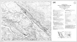
P. Schiarizza and R.G. Gaba
Geoscience Map 1993-08 presents the geology of the Bridge River map-area (92J/16) in southern British Columbia. The 1:50,000 scale geology map includes a legend and references.
The area is underlain by rocks of the Methow terrane, ophiolitic assemblages, Cadwallader and Bridge River terranes, and overlap assemblages. The Yalakom Mountain facies of the Methow terrane includes Jurassic and/or Cretaceous lithic arkosic sandstone, conglomerate, siltstone and shale; possible Lower and Middle Jurassic lithic-arkosic sandstone intercalated with lesser amounts of conglomerate, siltstone and shale; and Lower Cretaceous Jackass Mountain strata including a unit with lithic sandstone, conglomerate, and conglomeratic sandstone with lesser amounts of siltstone and shale, and a unit with arkosic sandstone, conglomeratic sandstone, siltstone, shale and conglomerate. Ophiolitic assemblages include the Shulaps Ultramafic complex and the Bralorne-East Liza complex. The Permian and younger and perhaps older Shulaps Ultramafic complex consists of a dominantly harzburgite unit and a serpentinite melange unit with knockers of gabbro, ultramafic rock, diorite, diabase, amphibolite, greenstone, roddingite, chert, phyllite, sandstone, conglomerate and limestone. The Permian Bralorne-East Liza complex contains pillowed and massive greenstones, greenstone breccia, diabase, gabbro and serpentinite. The oldest Cadwallader terrane rocks are of the Upper Triassic Cadwallader Group including a lower volcanic unit consisting mainly of greenstone, volcanic breccia and tuff; and the Hurley Formation sandstone, calcarenite, siltstone, and some conglomerate. There are also Lower to Middle Jurassic Last Creek Formation strata, mainly shale, siltstone, and siliceous argillite, and possibly Upper Jurassic to Lower Cretaceous siltstone and shale. Strata of the Bridge River complex of the Bridge River terrane range in age from Mississippian to Middle Jurassic. Units consist of biotite-quartz and biotite-chlorite-actinolite schist, calcareous actinolite schist, talc schist, metachert and marble; serpentinite with local slivers of all other Bridge River rock types; and ribbon chert, argillite, phyllite, quartz phyllite and pillowed to massive greenstone. Overlap assemblages include the Lower and/or Upper Cretaceous Silverquick Formation, with conglomerate, sandstone and siltstone; and the Tertiary Jones Creek volcanics, which are mainly porphyritic dacite and volcanic breccia.
Intrusive rocks in the area are of Eocene age. They include hornblende–biotite granodiorite, and hornblende-biotite-quartz-feldspar porphyry.
Deposition of the late Early Cretaceous rocks was coincident with the onset of regional compressional tectonism. Clasts within Silverquick conglomerate were derived from both the Bridge River complex and Cadwallader Group. The older Taylor Creek Group (not exposed in this map area) is the oldest unit within the Tyaughton basin and is documented to sit unconformably above Bridge River basement. This suggests the possibility that thrust imbrication (and accretion?) of the Bridge River and Cadwallader terranes was predominantly a late Early Cretaceous event.
The map area is cut by a northwest-trending system of dextral strike-slip faults that was active in Late Cretaceous time. Northerly trending splays of the Relay Creek-Marshall Creek fault system connect with the Yalakom fault system to define a large-scale extensional duplex structure. This fault system steps across and bounds the northwestern margin of the Shulaps ultramafic complex at its southeastern end. In contrast to the extensional zone to the northwest, the Shulaps complex may have been deformed and uplifted during Late Cretaceous movement on the bounding strike-slip fault systems.
Metallic mineral concentrations are within or adjacent to strike-slip faults or associated structures, and have a close spatial relationship with plutons or dykes. The age of mineralization seems closely tied to igneous activity between Late Cretaceous and Early Tertiary time. The protracted history of mineralization and plutonism combined with differential uplift across faults has led to the juxtaposition of deposits of contrasting structural level and local inconsistencies in the pattern of regional metal zoning.
The map area straddles the northern part of the Bridge River mining camp, which is British Columbia’s foremost historical gold producer from low sulphide mesothermal quartz veins. Other known and potential deposit types in the area are copper-molybdenum porphyries, pluton-associated high sulphide auriferous veins, skarns, scheelite-stibnite or stibnite-only veins, gold-silver polymetallic veins, epithermal gold-silver veins and cinnabar veins and disseminations. In addition, the ultramafic rocks have small chromite concentrations, and potential for jade, magnesite and chrysotile.
Cinnabar veinlets and disseminations occur locally near the Bridge River fault.
P. Schiarizza and R.G. Gaba
Geoscience Map 1993-09 presents the geology of the Noaxe Creek and southwest Big Bar Creek area (92O/1, 2). The publication consists of a 1:50,000 scale geology map with legend and reference list.
The area is underlain by strata of the Intermontane Belt and Methow terrane, Ophiolitic assemblages, strata of the Cadwallader, Bridge River and Relay Mountain terranes, and overlap assemblages. Intermontane Belt strata may be of Cretaceous age. They are represented by the Dash-Churn succession that consists of units dominated by volcanic conglomerate; andesitic volcanic breccia and lapilli tuff; and volcanic conglomerate and breccia. Methow Terrane is represented by the Churn Creek facies and the Yalakom Mountain facies. Churn Creek facies consists of Middle Jurassic siltstone and fine sandstone, and rocks of the Lower Cretaceous Jackass Mountain Group with a lower unit of lithic sandstone to pebble conglomerate, and an upper unit of pebble to boulder conglomerate. Yalakom Mountain facies contains a Lower (?) to Middle Jurassic unit dominated by lithic-arkosic sandstone, a Middle (?) Jurassic unit of mainly volcanic breccia and andesitic flows, and Lower Cretaceous Jackass mountain Group strata with a lower unit dominated by lithic sandstone, granule conglomerate and conglomeratic sandstone, and an upper unit of arkosic sandstone, conglomeratic sandstone, siltstone, shale and conglomerate. The Ophiolitic assemblages include an assemblage of serpentinite, serpentinized ultramafite, and listwanite altered rocks; the Permian and younger Shulaps Ultramafic Complex with a harzburgite unit and a serpentinite melange unit; and the Bralorne-East Liza Complex of serpentinite, gabbro, diabase, and pillowed and massive greenstones. Cadwallader Terrane strata include the Upper Triassic Cadwallader and Tyaughton Groups, and the Lower to Middle Jurassic Last Creek Formation. The Cadwallader Group is represented by the Hurley Formation, which consists of a volcanic greenstone-tuff unit, and a unit comprised mainly of sandstone, calcarenite and siltstone. Tyaughton Group strata consist of a lower unit dominated by conglomerate and conglomeratic sandstone intercalated with sandstone, and an upper unit of mainly limestone conglomerate that is overlain by sandstone and conglomerate. Bridge River Terrane is represented by the Bridge River Complex. The Bridge River Complex consists of Mississippian to Middle Jurassic strata consisting mainly of ribbon chert, argillite and pillowed to massive greenstone. The Relay Mountain Terrane of the Lower Tyaughton Basin contains Middle Jurassic to Lower Cretaceous strata. The lower unit is mainly siliceous shale intercalated with sandstone and siltstone; the middle unit is dominantly sandstone and siltstone; and the upper unit is mostly shale and siltstone.
The Relay Mountain-Bridge River overlap assemblage comprises the Upper Tyaughton Basin consists of the Lower and perhaps Upper Cretaceous Taylor Creek Group, the Lower and/or Upper Cretaceous Silverquick Formation, and the Upper Cretaceous Powell Creek Formation. The Taylor Creek Group has the lower, Elbow Pass Formation sandstone, shale and conglomerate; the Paradise Formation of shale and sandstone; the Dash Formation of mainly chert pebble conglomerate, chert-rich sandstone, shale and siltstone; the Lizard Formation with micaceous sandstone and shale; a unit of volcanic breccia; and the Beece Creek succession of sandstone, siltstone and shale. The Silverquick Formation comprises mainly pebble to cobble conglomerate, and the Powell Creek Formation is mainly volcanic breccia and lapilli tuff. Tertiary rocks include the Miocene and possibly Pliocene Red Mountain volcanics, with a lower sedimentary unit overlain by andesite flows and rhyolite that is partly intrusive, the Big Sheep Mountain rhyolites, and olivine basalt flows of the Chilcotin Group.
Intrusive rocks in the area include Late Cretaceous and/or Early Tertiary hornblende-bearing porphyries, and quartz diorite to granodiorite, and Tertiary hornblende-biotite-quartz feldspar porphyries, quartz diorite and granodiorite, and Miocene or Pliocene mafic plugs.
The map area is cut by a northwest-trending system of dextral strike-slip faults that was active in Late Cretaceous time. Northerly trending splays of the Relay Creek-Marshall Creek fault system connect with the Yalakom fault system to define a large-scale extensional duplex structure. This fault system steps across and bounds the northwestern margin of the Shulaps ultramafic complex at its southeastern end. In contrast to the extensional zone to the northwest, the Shulaps complex may have been deformed and uplifted during Late Cretaceous movement on the bounding strike-slip fault systems.
The map area includes strata similar to those that host the Bridge River mining camp, British Columbia’s foremost historical gold producer from low sulphide mesothermal quartz veins. Other known and potential deposit types in the area are copper-molybdenum porphyries, pluton-associated high sulphide auriferous veins, skarns, scheelite-stibnite or stibnite-only veins, gold-silver polymetallic veins, epithermal gold-silver veins and cinnabar veins and disseminations.
Metallic mineral concentrations within or adjacent to strike-slip faults or associated structures have a close spatial relationship with plutons or dykes. The age of mineralization seems closely tied to igneous activity between Late Cretaceous and Early Tertiary time. The protracted history of mineralization and plutonism combined with differential uplift across faults has led to the juxtaposition of deposits of contrasting structural level. In addition, the ultramafic rocks have small chromite concentrations, and potential for jade, magnesite and chrysotile.
P. Schiarizza and R.G. Gaba
Geoscience Map 1993-10 describes the geology of the Warner Pass map area (92O/3) in southern British Columbia.
The map-area includes rocks of the Methow terrane, the Cadwallader terrane, the Relay mountain terrane, the Relay Mountain-Bridge River overlap assemblage, and Tertiary strata. Methow terrane rocks are Lower Cretaceous sandstone, conglomerate, siltstone and shale of the Jackass Mountain Group. Cadwallader terrane is represented by the Late Triassic Tyaughton Group and the Lower to Middle Jurassic Last Creek Formation. The Tyaughton Group has a lower conglomerate, conglomeratic sandstone, and red to brown sandstone unit, and a unit with limestone conglomerate overlain by green sandstone intercalated with conglomerate, overlain by brown sandstone that is overlain by green sandstone with thin conglomerate interbeds. Last Creek Formation contains brown calcareous sandstone, siltstone and conglomerate that are overlain by dark calcareous shale. Relay Mountain terrane strata are of Middle Jurassic to Lower Cretaceous age. The older Relay Mountain Group has three units. The lowest consists of dark siliceous shale intercalated with siltstone and sandstone; the middle unit has fossiliferous sandstone and siltstone; and the upper unit is mainly dark shale and siltstone. The younger Tosh Creek unit is mainly volcanic conglomerate and breccia, and dark shale but has intercalations of siltstone, sandstone and intermediate volcanic rocks. The Overlap assemblage consists of the Lower and perhaps Upper Cretaceous Taylor Creek Group, and the Upper Cretaceous Powell Creek Formation. The Taylor Creek contains sandstone, shale and conglomerate of the Elbow Pass Formation; shale, sandstone, and some conglomerate of the Paradise Formation; chert pebble conglomerate, sandstone, shale and siltstone of the Dash Formation, micaceous sandstone and shale of the Lizard Formation, an intermediate, felsic and mafic flow, tuff and breccia unit with conglomerate, sandstone and shale; and sandstone, siltstone, shale, conglomerate, calcareous sandstone and shale, and ash and crystal tuff. Powell Creek Formation strata include a lower unit of conglomerate, sandstone and shale, a middle unit of andesitic volcanic breccia, lapilli and ash tuff, mafic to intermediate flows, sandstone and conglomerate; and an upper unit of lapilli tuff, volcanic breccia, lahar, conglomerate and sandstone. Tertiary strata include the Paleocene and/or Eocene Mount Sheba volcanics, with intermediate to felsic flows, tuffs and breccias, conglomerate and mudstone of the Cluckata Ridge succession, an intermediate to felsic volcanic flow unit; and basalt flows and flow breccia. Olivine basalt flows comprise the Miocene and perhaps Pliocene Chilcotin Group.
Intrusive rocks in the area include Late Cretaceous granodiorite; Late Cretaceous and/or Early Tertiary diorite and gabbro, and hornblende-feldspar porphyry bodies; Paleocene and/or Eocene hornblende-biotite-quartz-feldspar porphyry; Eocene quartz monzonite and granodiorite; and Oligocene hornblende porphyry.
The structural elements are similar to those to the south with northwest trending, southwest-directed thrusting and north or northwest striking high angle faults with undefined but presumably transcurrent and vertical offsets.
The map area lies northwest of the Bridge River mining camp, which is British Columbia’s foremost historical gold producer from low sulphide mesothermal quartz veins. Other known and potential deposit types in the area are copper-molybdenum porphyries, pluton-associated high sulphide auriferous veins, skarns, scheelite-stibnite or stibnite-only veins, gold-silver polymetallic veins, epithermal gold-silver veins and cinnabar veins and disseminations.
1991
N.W.D. Massey, S.J. Friday, J.M. Riddell and S.E. Dumais
Geoscience Map 1991-01 presents the geology of the Port Alberni-Nanaimo Lakes area (NTS 092F/1W, 2E and part of 092F/7E) and is at 1:50,000 scale. The map covers the northwestern portion of the Cowichan uplift. This geanticlinal uplift is cored by island-arc volcanics of the Devonian Sicker Group overlain by marginal basin and platformal sediments of the Mississippian to Lower Permian Buttle Lake Group. The uplift is flanked by basalts of the Upper Triassic Karmutsen Formation and granodiorite intrusions of the Island plutonic suite. Clastic sediments of the Upper Cretaceous Nanaimo Group overlie older rocks and are intruded by Eocene porphyries. The uplift is dissected by numerous faults, including major contractional faults of the Eocene Cowichan fold and thrust system. The map sheet contains 113 known mineral deposits and occurrences. Past production has been confined to placer and lode gold deposits, although volcanogenic massive sulphides and oxide exhalites, porphyry copper-molybdenum veins and stockworks, iron-copper skarns, base-metal veins and various industrial minerals are also found within the area.
N.W.D. Massey, S.J. Friday, P.E. Tercier, V.J. Rublee and T.E. Potter
Geoscience Map 1991-02 describes the geology of the Cowichan Lake area. It is a 1:50,000-scale map covering the southwestern flank of the Cowichan uplift. North of Cowichan Lake, the area is underlain by island-arc volcanics of the Devonian Sicker Group and marginal basin and platformal sediments of the Mississippian to Lower Permian Buttle Lake Group. South of the lake, separated from the Paleozoic sequence by the Cowichan fault, Mesozoic volcanics and sediments form a broad anticline. The Upper Triassic basalts and sediments of the Karmutsen, Quatsino and Parson Bay formations are overlain by arc volcanics of the Lower Jurassic Bonanza Group. Granodiorite stocks and plutons of the early to middle Jurassic Island plutonic suite intrude all older sequences. Clastic sediments of the Upper Cretaceous Nanaimo Group occur throughout the map area, preserved in the footwalls of major contractional faults associated with the Eocene fold and thrust system. The map sheet contains 39 documented mineral deposits and occurrences, though past production has been limited to the copper skarn deposit of the Blue Grouse mine. Other mineralization includes lode gold, base metal veins, porphyry copper-molybdenum veins and stockworks, volcanogenic exhalites, rhodonite, limestone and placer gold.
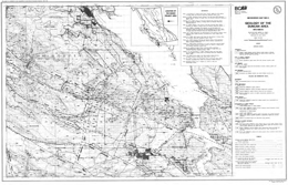
N.W.D. Massey, S.J. Friday, P.E. Tercier and T.E. Potter
Geoscience Map 1991-03 portrays the geology of the Duncan area (NTS 092B/13), Vancouver Island British Columbia. This 1:50,000 scale map sheet covers the southwestern end of the Cowichan uplift. The uplift is cored by island-arc volcanics of the Devonian Sicker Group, and associated granodiorite and quartz-porphyry of the Saltspring intrusive suite, overlain by marginal basin and platformal sediments of the Mississippian to Lower Permian Buttle Lake Group. The Paleozoic sequences are intruded by dikes and sills of the late Triassic Mount Hall gabbro, and granodiorite stocks and plutons of the Island intrusive suite. Siliciclastic sediments of the Nanaimo Group overlie older rocks in the Cowichan valley and the coastal areas. The area has been disrupted and deformed by major contractional faults of the Eocene Cowichan fold and thrust system. The map area contains 52 documented mineral deposits and occurrences. The bulk of past production has come from rhodonite and manganese of the Hill 60 area, lode gold of Mount Richards, and various clay and aggregate sources. Other showings consist predominantly of volcanogenic massive sulphides, oxide exhalites and lode gold and copper veins but porphyry copper-molybdenum veins, rhodonite and other industrial minerals are also present within the area.
