Launch of GeoNetBC - April 2025
Launch GeoNetBC
What is Happening
-
After over 30 years of service, the MAnagement of Survey Control Operations and Tasks (MASCOT) database system, which supports a network of over 60,000 survey control monuments situated throughout British Columbia, is slated for replacement.
- GeoBC has been developing a new and modern database system called GeoNetBC to replace the MASCOT system.
- GeoNetBC will provide improved user experience and operational efficiency, reducing processing times and establishing a modernized system that will be adaptable to future datums and technology needs.
- GeoNetBC will align with best practices in Natural Resources Canada’s geodetic infrastructure and be responsive to the needs of BC’s surveying community.
- GeoNetBC is now in its final testing stages and a soft launch period is projected to begin April 30th, 2025.
- During this soft launch period, both MASCOT and GeoNetBC will be available simultaneously, however updates will only be done in GeoNetBC, with MASCOT running in view only mode as a backup.
- Users are encouraged to provide feedback on the new system via email to GeoBCinfo@gov.bc.ca with GeoNetBC Feedback in the subject line.
About MASCOT
GeoBC is mandated to maintain the official database record of BC Geodetic Control Monument Information. Historically, this data has been accessed using the MASCOT database system. MASCOT has been critical for the accuracy of all legal surveys, administrative boundaries, geodetic elevations, remote sensing technologies, and geospatial data and products in the province. Since the early 1990’s, MASCOT has been an expedient and cost-effective means for surveyors and engineers to access B.C.’s official geodetic control data. However, after over 30 years of service, the MASCOT system cannot meet the modern demands for security and future upgrades to modern datums and technology standards.
About GeoNetBC
GeoNetBC will replace MASCOT and align with best practices of Natural Resources Canada’s geodetic database and meet the current requirements of British Columbia’s surveying community. GeoNetBC is a cloud-based system that has better integration with new technologies, faster data processing, and the capability for easier system updates and improvements. GeoNetBC will also support future datums, which allows for the integration of emerging geodetic standards and technologies.

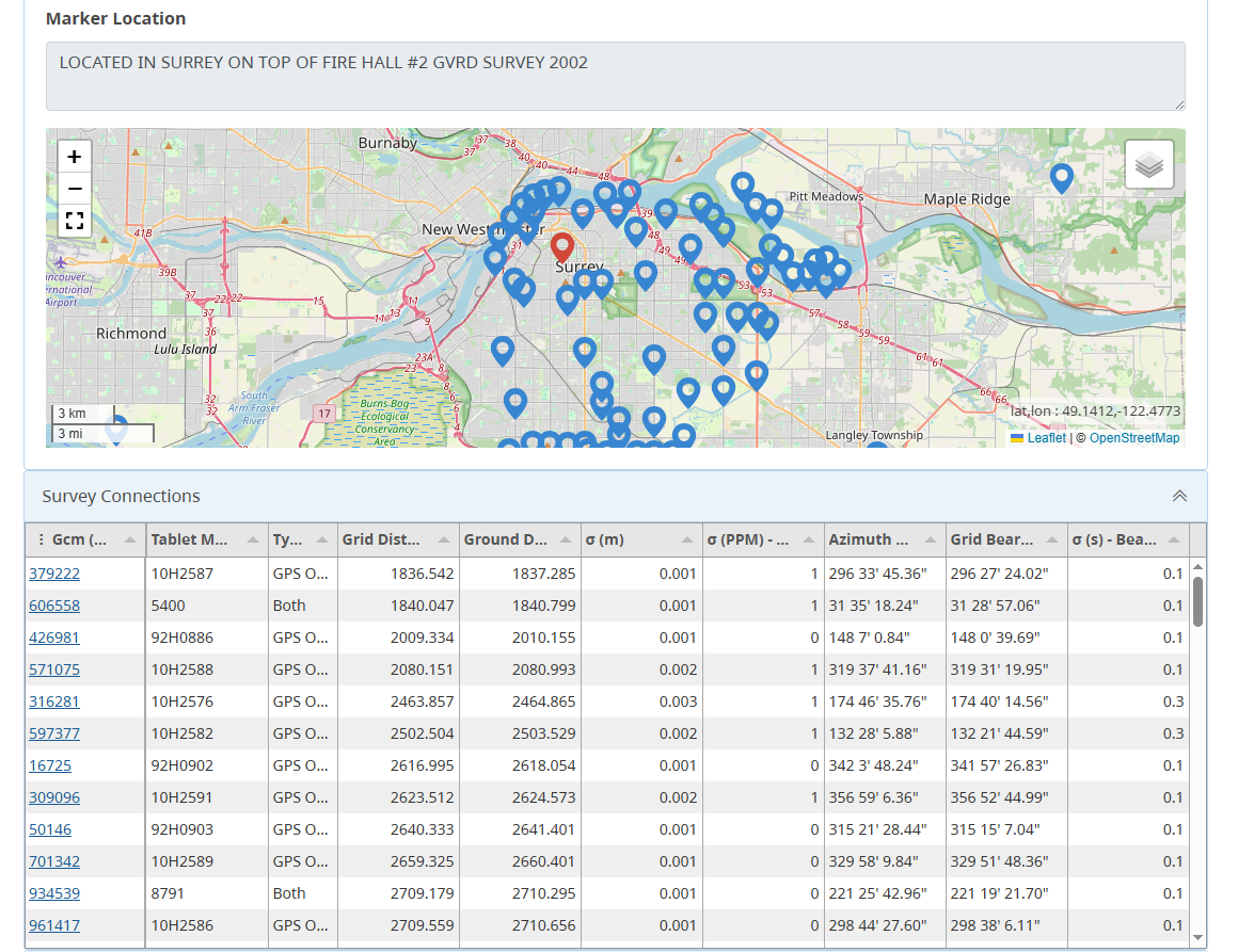
Map of geodetic control monuments in Surrey, BC with a table of associated survey connections.
