
Mount Polley Mine
The Mount Polley Mine ('the mine') is an operating copper-gold mine operated by Imperial Metals Ltd.
On this page
The mine is located near Likely, B.C., in the traditional territory of:
- Xat’sull First Nation
- Williams Lake First Nation
- Whispering Pines, Neskonlith and Northern Secwepemc te Qelmucw First Nations
In 2014, a breach occurred at the tailings storage facility (TSF).
This page includes a summary of:
- The 2014 tailings dam breach
- Ongoing permitting, monitoring and compliance activities regulated by the Ministry of Environment and Climate Change Strategy
Tailings dam breach 2014
A tailings dam failure at the Mount Polley Mine occurred on August 4, 2014. This resulted in the loss of about 17 million cubic meters of water and 8 million cubic meters of tailings/materials into Polley Lake, Hazeltine Creek and Quesnel Lake with significant impact.
An emergency response was undertaken by the province involving various agencies throughout August and into September 2014. A Pollution Abatement Order under the Environmental Management Act (EMA) was issued on August 5, 2014 and amended several times between 2015 and 2017 to abate the discharge, undertake an environmental impact assessment of the breach and implement remediation activities.
The Pollution Abatement Order was cancelled on September 12, 2019 based on completion of the activities required by the Order. Ongoing monitoring is now a requirement under the effluent discharge permit.
A Letter of Understanding between the province and Soda Creek Indian Band and Williams Lake Indian Band outlines a collaborative approach to jointly address all aspects of the tailings breach.
The ministry led the response for the environmental monitoring, impact assessment, mitigation and remediation of the area impacted as a result of the Mount Polley Mine tailings breach. This work was undertaken with First Nations, local governments, provincial and federal agencies and public representatives.
Permits, orders and reports
Environmental Management Act: Permit
- The most recent version of the Permit is available on AMS
- Search for authorization number '11678'
- Infographics for Mount Polley Long-term Water Management Plan (PDF, 3MB)
- Visit the AMS and search for 'Authorization Number 11678' for previous permits, orders and report documentation
- Learn more about permitting processes
Environmental Management Act: Pollution Abatement Order
Superseded
- September 12, 2019: PAO Cancellation (PDF, 56KB)
- January 19, 2017: PAO Amended (PDF)
- December 30, 2016: PAO Amended (PDF)
- November 30, 2016: PAO Amended (PDF)
- April 27, 2016: PAO Amended (PDF)
- January 15, 2016: PAO Amended (PDF)
- February 24, 2015: PAO Additional Clarification Letter (PDF, 207KB)
- December 18, 2015: PAO Amended (PDF)
- June 9, 2017: PAO Amended (PDF)
- June 15, 2015: PAO Requirements Letter (PDF)
- May 27, 2015: PAO Amended (PDF)
- February 20, 2015: PAO Clarification Letter (PDF)
- August 5, 2014: Pollution Abatement Order (PDF)
Remediation and restoration
Comprehensive Environmental Impact Assessment: Action Plan
Post-event Environmental Impact Assessment Report
- June 9, 2015: MPMC PEEIAR v.1 Summary Report (PDF, 50MB)
- June 3, 2016: MPMC PEEIAR v.2 Summary Report (PDF, 2.2MB)
Detailed site investigation
Human Health and Ecological Risk Assessment (ERA)
Progress reports
MPMC reports in support of the Permit and Order
Environmental and reclamation reports
Annual environmental and reclamation reports can be found at BC Mine Information.
Post-breach reports
- May 13, 2016: Q1 2016 Post TSF-Breach Monitoring Report (PDF)
- February 5, 2016: Q4 2016 Post TSF-Breach Monitoring Report (PDF)
- November 12, 2015: Q3 2015 Post TSF-Breach Monitoring Report (PDF)
- August 15, 2015: Q2 2015 Post TSF-Breach Monitoring Report (PDF)
Technical assessment reports
- August 17, 2022: Public Consultation Report (Mount Polley Mine Quesnel Lake Interim Discharge) (PDF, 1.3MB)
- June 16, 2022: MPMC Quesnel Lake Discharge Interim Extension: Technical Assessment Report
- This report is available upon request
- March 10, 2017: Public Consultation Report (Mount Polley Mine LTWMP) (PDF)
- October 17, 2016: MPMC Long-term Effluent Discharge TAR (PDF, 220MB)
- May 29, 2015: MPMC Short-term Effluent Discharge TAR (PDF)
Sampling and monitoring
Overview
The Ministry of Environment and Climate Change Strategy commissioned a report to compile existing data for water, sediment and living organisms in the Quesnel Lake watershed, including Hazeltine Creek and Polley Lake.
This information was used to better understand the effects of the 2014 Mount Polley tailings pond breach on aquatic ecosystems.
The report:
- Describes the steps used to create a searchable database
- Identifies gaps in the data
- Uses the data to compare pre-breach and post-breach conditions
Recommendations for future work include filling the data gaps and establishing a standard sampling scheme so new data can be easily incorporated into the database for future use.
Construction and assessment reports
Maps
Interactive map
- Interactive map of all types of sampling sites
- Hosted by DataBC
PDF map
- Map of All Types of Sampling Sites (11x17 inches) (PDF, 1.4MB)
- An interactive map is currently in development
Comprehensive Environmental Monitoring Plan
In 2015, Permit 11678 was amended. It required Mount Polley Mining Corporation to develop, submit and implement and ongoing Comprehensive Environmental Monitoring Plan (CEMP).
The objectives of the CEMP are to:
- Monitor and evaluate the potential effects of the existing mining operation
- Evaluate the effects of the August 2014 dam breach
- Inform and monitor the rehabilitation plan and its implementation
- Meet the Mines Act and the Federal Metal, Diamond Mine Effluent Regulation
This plan evaluates the effects of mining-related activities on the physical, chemical and biological characteristics of:
- Hazeltine Creek
- Edney Creek
- Bootjack Lake
- Morehead Creek
- Polley Lake
- Quesnel Lake
- Quesnel River, and associated riparian and upland areas
The most recent version of the CEMP (October 31, 2019) was approved by the Ministry of Environment and Climate Change Strategy on February 10, 2021.
The CEMP must be updated every 3 years. The next update was due on March 31, 2023.
The updated CEMP will be posted when it's approved.
Plans and letters
- CEMP Approval Letter (February 10, 2021) (PDF, 216KB)
- CEMP (October 31, 2019) (PDF, 14MB)
- Appendices are available upon request
Mount Polley Mining Corporation must submit a detailed monitoring program interpretive report every 3 years:
- 2021 Annual Environmental Report for the Mountain Polley Mine (March 2022) (PDF, 19MB)
- Appendices are available upon request
MPMC results
Visit the MPMC website for details.
Compliance
Compliance inspections can be viewed on the Natural Resources Compliance and Enforcement Database:
- Search for current and historical Permit inspections by searching ‘11678’
- Search for historical Pollution Abatement Order inspections by searching ‘107461'
This interactive map shows the surface water and groundwater monitoring locations on and around the Mount Polley mine.

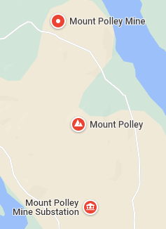
Map of the Mount Polley site location.